
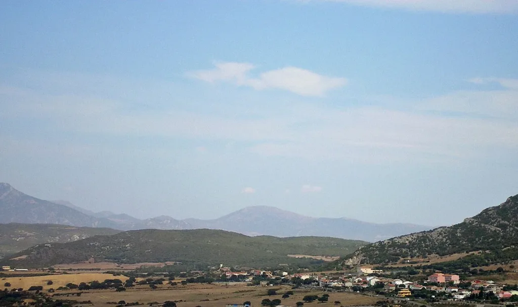

Barbusi makes sense when its houses, countryside and transport structures are considered together. This village within the municipality of Carbonia retains a setting distinct from the main town. Seen from Monte Sirai, buildings stretch beneath the hills while agricultural spaces remain clearly visible. It is a landscape in which living and travelling have left different traces, from the village street to railway buildings and bridges around the settlement.
The Barbusi municipal library entry provides a useful map reference for the village. Its marker identifies a local service, rather than the church entrance or an access point to railway remains. This matters when planning a first visit: the photographs assembled here show separate places. They do not describe a continuous, equipped or waymarked walking route connecting every structure featured in the article.
A community older than the new town
Giampaolo Atzei's research, published by the diocesan newspaper Sulcis Iglesiente Oggi in 2022 and based on parish records, explains that Barbusi belonged to Serbariu before becoming part of Carbonia. The village therefore already had its own history when the mining town was established. Its position connected the Iglesiente and Sulcis with routes towards Villamassargia and Cagliari, creating a geography of movement that existed well before widespread car ownership.

The broad view helps distinguish this background from that of a neighbourhood designed and built in one concentrated campaign. Fields, vegetation and buildings leave visible gaps; housing does not occupy the land evenly. Municipal planning studies concerning rural settlements place these communities within changes associated with mining employment as well as agriculture. The two activities belong to the same territorial history, although the physical evidence they left is very different.
Building Santa Maria delle Grazie over generations
The church gives that extended community history a particularly tangible form. Parish research records Antioca Carta's donation of land in 1891 and the laying of the foundation stone on 2 July 1923. Work resumed in 1947, and the building was completed in 1956. Spread across several generations, those dates describe a gradual undertaking supported by different people and resources, rather than a single project completed when Carbonia was founded.
Via Santa Maria delle Grazie remains a reference point for local collective life. A municipal notice records the fourth Sagra de is Traballusu Antigu here on 31 July 2026, including temporary traffic arrangements outside the church. It is dated evidence of a street being used for a community occasion. It is not a timetable for subsequent years: anyone hoping to attend a later edition should consult the announcement for that particular event.
The former FMS railway halt
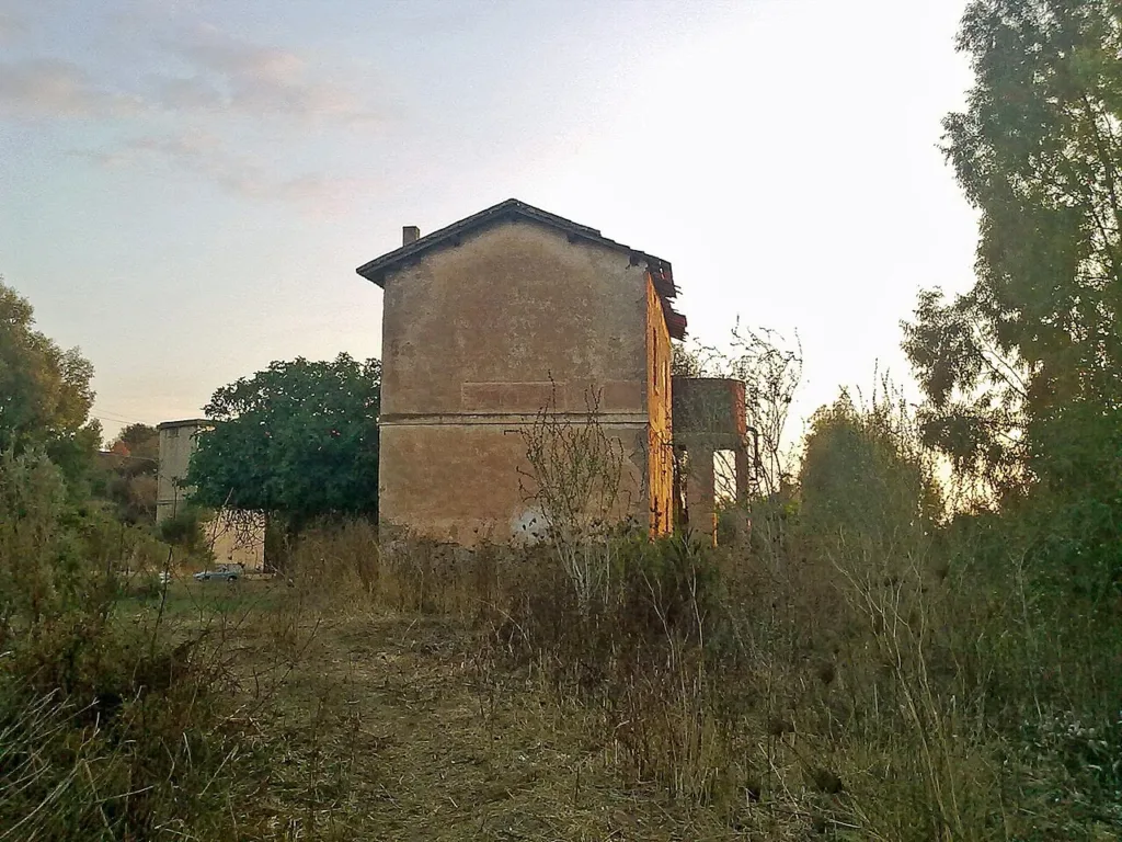
Rail transport added another network of connections. The Geomining Park dates the inauguration of the FMS lines to 13 May 1926 and records their 950-millimetre track gauge. Barbusi lay on the connection between Iglesias and the southern Sulcis. The small building photographed in 2013 belonged to that historic railway. Its modest size and surrounding vegetation immediately distinguish its appearance from that of a large urban station serving a busy central district.
This photograph documents a disused railway structure; it does not establish permission to enter the building or follow the former track bed. Read it instead as evidence of a connection, a place where village life met a network extending far beyond the settlement. The Park's account of the FMS provides further information about routes, vehicles and subsequent changes without requiring the visitor to treat every surviving railway feature as an accessible walking trail.

A bridge on a different railway
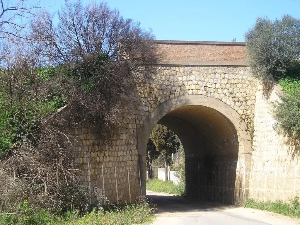
The arched bridge in the third image belongs to the Villamassargia–Carbonia Stato railway. It is therefore not another view of the same FMS halt. The photograph, taken in 2005, shows stone facing, the upper parapet and a road passage beneath the arch. Placing these images beside one another helps identify two separate infrastructures, avoiding the mistaken reconstruction of a single railway simply because the structures stand in the same general area.
Start an exploration of Barbusi with the settlement and its main street, keeping village orientation separate from any search for railway structures. Observe those structures only from publicly accessible spaces and stay away from railway tracks. Church, houses and transport links are connected by the continuity of the community. An existing village experienced the territory's industrial transformation while retaining places and names that reveal a longer story than the creation of Carbonia alone.