

At Capo Altano, Portoscuso's shoreline changes character: rock faces and the edge of the headland become the main elements of the view. The sea is more than a blue background; it is one of the forces shaping the coast. Understanding the place involves connecting three features: the form of the cliffs, traces of military observation and the modern route through the landscape. Together they reveal a coast used and altered by people, whose visual appeal also reflects natural processes that remain active.
The Capo Altano directory entry locates the headland north of central Portoscuso. This article focuses on the high rocky coast; nearby Portopaglietto beach has different characteristics and its own separate guide. That distinction is practical as well as descriptive. An impressive cliff view does not imply access to the water, and the presence of a cycle path does not make every surrounding stretch of ground passable. Landscape interpretation and route planning need to remain separate questions.
A rocky edge that keeps changing
Sardinia's Regional Landscape Plan places Capo Altano within the high coastal system extending towards Guroneddu and Porto Paglia. Its description refers to landforms associated with volcanic activity and identifies erosion and slope movement. This is consequently not an unchanging wall shaped once and for all in the distant past. Geological structure supplies the material and its discontinuities, while external processes continue to alter the edge and surface of the coast. Looking at its form involves considering both origins and ongoing change.

A territorial document published by the Region includes Capo Altano among examples of cliff coast, explaining the relationship between marine erosion, collapse and retreat of the edge. This is a way of interpreting the landscape, not a prediction about the stability of any particular viewpoint. Photographs may show blocks, inclined surfaces and variations in colour; they cannot establish which sections are safe to approach. Scientific assessment and local access instructions answer different questions from those raised by an attractive coastal image.
Nearby rocks and distant islands
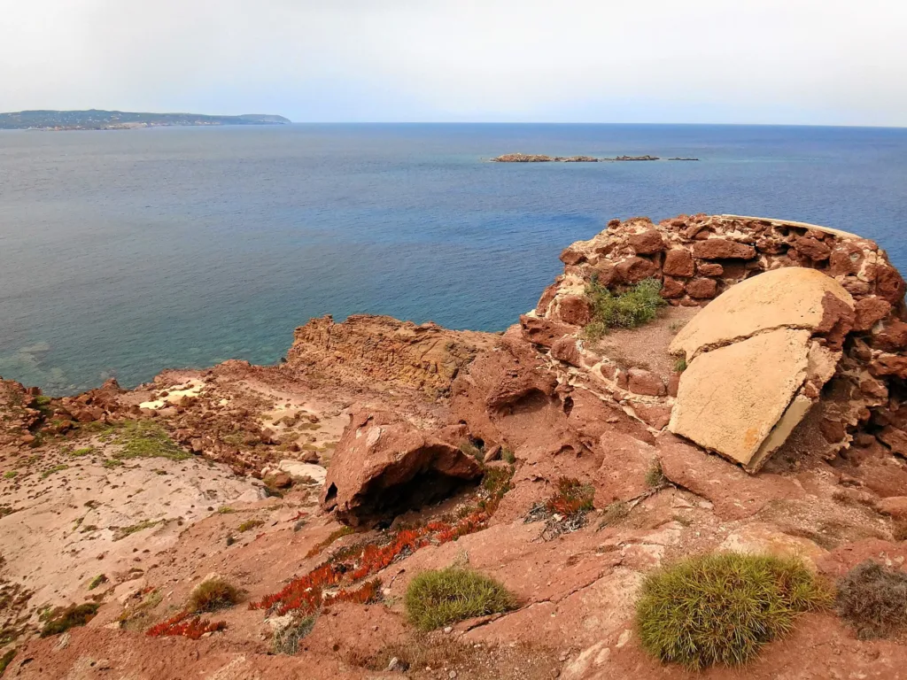
In the panoramic photograph reproduced here, reddish rocks occupy the foreground while San Pietro island appears along the horizon. The composition highlights the contrast between close detail and distant outlines. Cracks and angular surfaces attract attention first, before the view opens onto the sea. It illustrates the headland's panoramic character without recommending that visitors reach the photographer's exact position. A photograph records a viewpoint at a particular moment; it is not confirmation that access to that position is currently permitted.
Sardegna Turismo describes visual connections from Capo Altano towards San Pietro, the northern part of Sant'Antioco and the Iglesiente coast. How clearly those outlines appear depends on visibility and the observation point. For orientation, identify the larger land masses on a map before comparing them with the view, rather than immediately assigning names to every distant shape. This approach turns the coast into a relationship between recognisable places, instead of a disconnected succession of headlands or islands along an unfamiliar horizon.
Traces of military observation
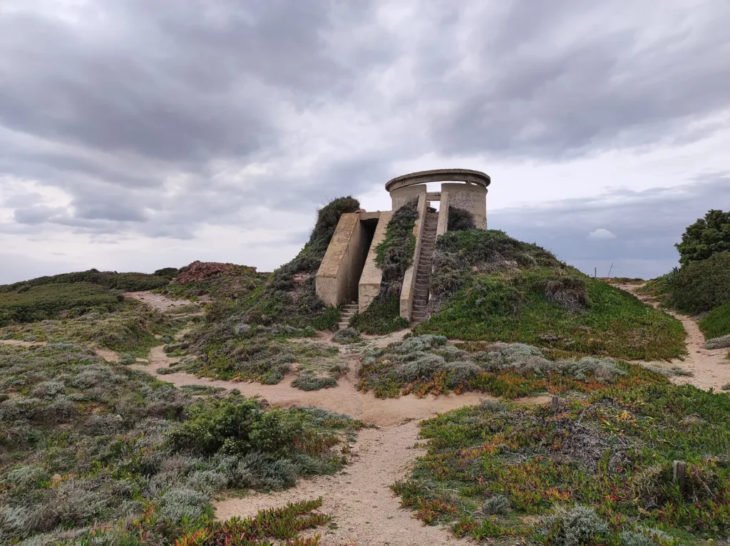
Regional tourism sources mention abandoned military fortifications on the headland. The cover photograph shows a partially surviving structure with steps and a circular upper element. Its relationship with the horizon helps explain the character of an installation directed towards the sea. However, a date, military unit or precise technical function should not be assigned to every fragment without dedicated documentation. Recognising military use does not by itself reconstruct the complete organisation of a battery or establish the purpose of every surviving wall.
These remains introduce a different timescale. Rocks reflect very long processes, while the building records a human decision to oversee the same stretch of sea. Their juxtaposition is meaningful even when observed from outside. Entering abandoned rooms or climbing deteriorated steps is unnecessary to understand the relationship between elevation, orientation and visibility. The structure's incomplete preservation forms part of its present condition. It deserves attention as evidence within the landscape rather than as a platform that visitors should assume they can use.

The cycle path and access information
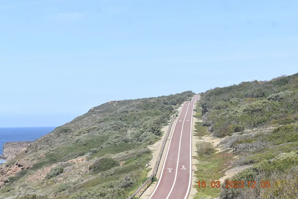
The third photograph documents the Capo Altano cycle path within its coastal setting. A constructed line runs through low vegetation and follows the profile of the terrain. Its presence distinguishes a dedicated infrastructure from informal tracks across the ground. Nevertheless, the photograph is not a report on today's conditions and does not guarantee that every connection remains continuous or open. Anyone planning a walk or cycle ride should check signs, possible interruptions and current information issued by the municipality before deciding on a route.
The municipal Mare On Line page, which includes references to the 2019 season, recalls measures introduced in 2010 following a landslide near the point. It is cited here as documentation of the issue, not as a complete check of restrictions currently in force. Consult the municipality and maritime authority and follow barriers and notices on site. Understanding Capo Altano means appreciating the shapes of its coast while recognising that the processes responsible for those shapes have not stopped.