
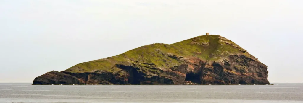

From Capo Sperone, the sea is not an empty space without landmarks. Profiles on the horizon help explain the southern end of Sant'Antioco. Vacca, Vitello and Toro are separate names for different outcrops, not interchangeable labels for the same rock. Observing them from the coast offers a way to understand the archipelago without travelling onto the islets. The three photographs in this article were taken from Capo Sperone and show these maritime reference points, each with its own recognisable outline.
The Capo Sperone cliff directory entry locates a coastal point. It assists orientation within the municipality of Sant'Antioco, rather than identifying an island landing or a certified hiking route. The name Capo Sperone concerns an area larger than that single map position. Understanding the panorama means separating the coast from which one looks, the intervening sea and the land emerging beyond it, keeping these different geographical layers distinct.
Three outlines and different impressions of distance
In the photograph of Vacca, the land appears elongated, with an uneven summit and steeper faces along one side. Vegetation adds green tones above the rock. The view contains enough detail to distinguish different surfaces, but not to identify every plant or recess. The island's name is documented by the photographic source. Recognition does not depend on inventing a resemblance to the animal evoked by its Italian place name or treating that resemblance as a geographical explanation.
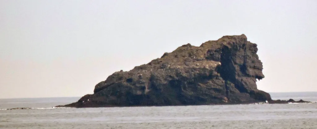

Vitello appears instead as a compact rocky mass, with a face rising sharply from the water and a broken upper outline. Sant'Antioco's tourism portal describes it as the rock adjacent to Vacca. A close photograph can make it appear larger or more prominent than a distant view of the other island. Compare the images for shape rather than as a measuring scale: lenses and framing can greatly change the apparent proportions of features photographed from the coast.
Toro and the visual effect of remoteness
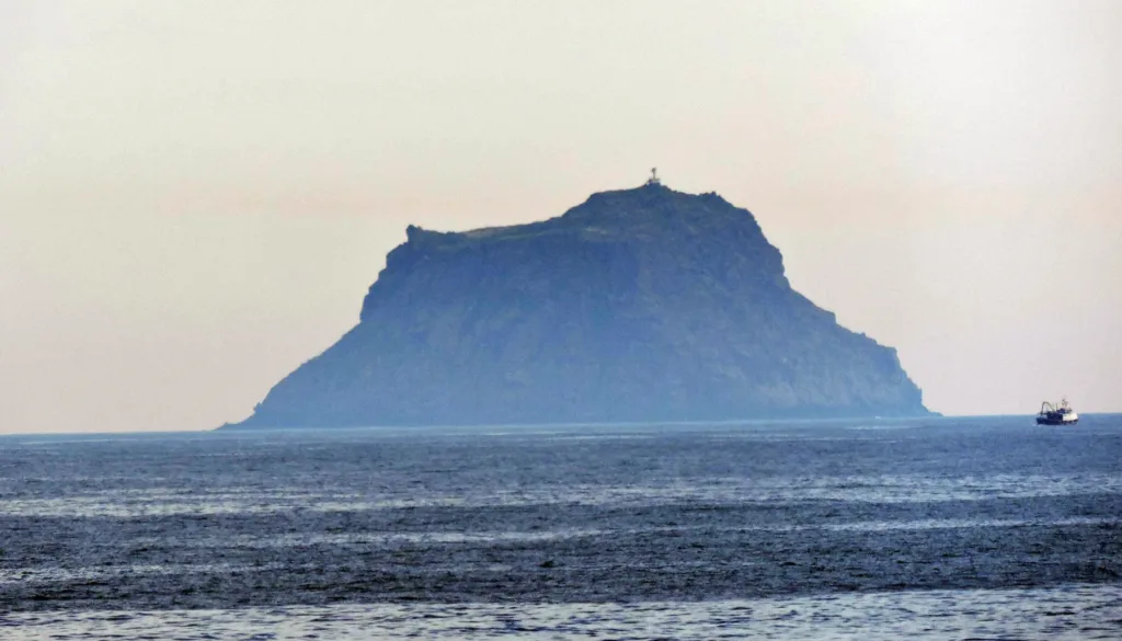
The tourism source identifies Toro as the most distant of the group. In the photograph it has a relatively flat summit and pronounced sides, while distance softens the detail. Its bluish tone contrasts with the sharper views of the other outcrops. This difference in appearance helps communicate the depth of the scene. It cannot, however, establish the rocks' actual colour or demonstrate the presence of particular plant species on the island's slopes or summit.
Binoculars can make the outlines easier to read while remaining at a stable position on the coast. First find a silhouette with the naked eye, then look for details without losing its relationship to the horizon. The value of observation does not depend on getting as close as possible to a cliff edge. These photographs illustrate distant views; they do not propose a landing or establish suitable sea conditions for taking a boat out towards the islands.
A varied landscape behind the coastal view
Visit Sant'Antioco describes Capo Sperone as rocky terrain with Mediterranean scrub and cliffs especially along its western sector, while also mentioning vineyards, olive groves and pasture. The landscape is therefore not composed entirely of apparently untouched nature. The regional document concerning the Sulcis Islands district records several types of land cover for the Capo Sperone area. Agricultural uses alongside spontaneous vegetation help explain the surroundings encountered before arriving at the coastal edge itself.
The municipal coastal-use plan describes discontinuous vegetation and plants adapted to exposure near the sea, including sea lavender and everlasting. Further inland it mentions mastic and dwarf palm. This distinction matters because vegetation is not a uniform covering: distance from the water, exposed rock and available soil create different conditions. Recognising those changes is already a form of natural observation, even without assigning a botanical name to every individual plant encountered while moving through the landscape.

A view that is also habitat
Capo Sperone falls within the Special Protection Area identified as ITB043032. Regional documentation also distinguishes sites associated with the islets: appearing in one panorama does not mean that all its features form a single undifferentiated administrative area. The tourism portal highlights Vacca and Toro's importance for birdlife, including Eleonora's falcon. Their significance concerns habitat, not a promise that an animal will appear during every stop or can be identified within the landscape photographs published here.
Enjoying the view can include respecting distance: observe without calling birds towards you, remain on permitted passages and avoid treating the islets merely as targets to reach. Finish by comparing the three profiles once more before exploring other accounts in the Sant'Antioco story archive. Capo Sperone then becomes a place from which relationships between land and sea can be understood, rather than simply a background for a photograph taken near the island's southern end.