
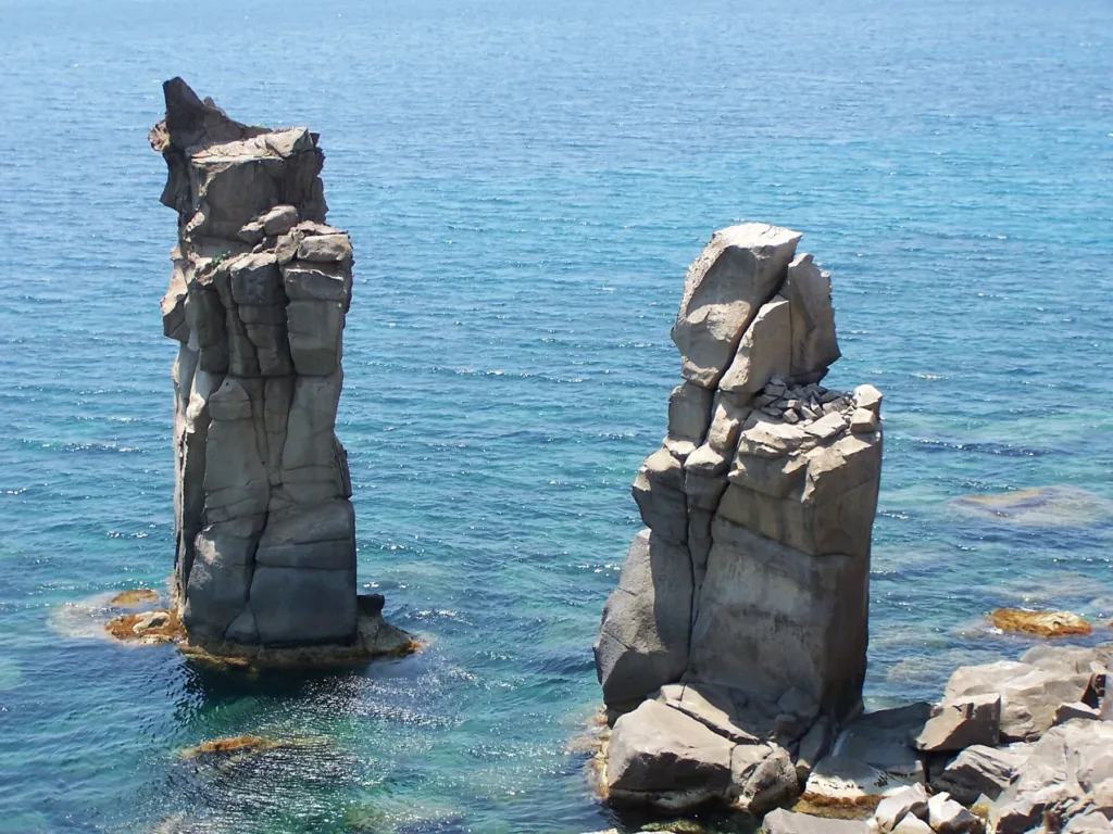

The name Le Colonne preserves an image that the sea has altered. At the southern end of San Pietro island, within the municipality of Carloforte, these sea stacks became a landmark in both the landscape and local memory. Photographs showing two well-developed pillars still circulate, but they should not be read as an up-to-date description. SardegnaTurismo records collapses associated with storms, particularly those of November 2013, after which only the base of one of the two formations remained.
That change offers a way to understand the place rather than a reason to dismiss it. The Le Colonne directory entry identifies the location, while the landscape itself consists of changing relationships between cliffs, fractures and blocks. The aim is not to find an exact copy of a postcard seen before travelling. It is to recognise that a natural landmark can retain its name even after its appearance has been substantially transformed by coastal processes.
Three photographs as historical documents
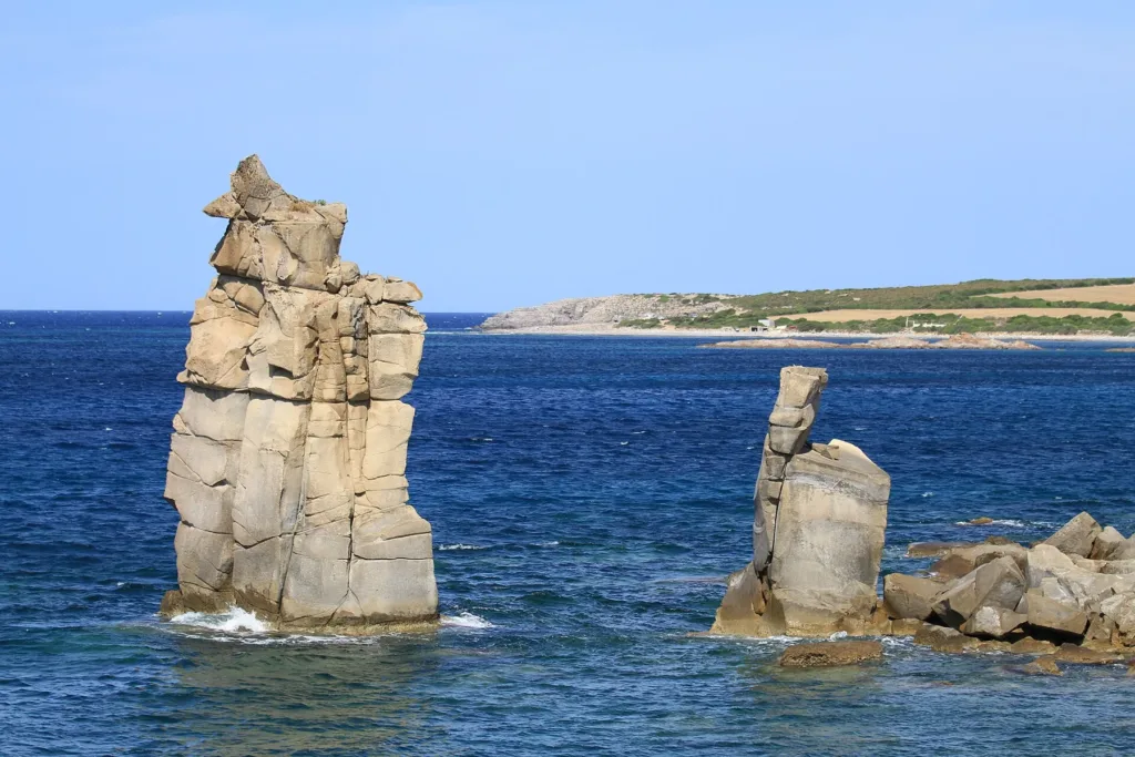
The cover photograph was taken in June 2005 and shows the pillars before subsequent collapses. A second image was uploaded in 2006, which also makes it a historical record, although an upload date should not be converted into a precise date of photography. The third was taken in July 2012. Those details are part of the story: they allow the images to function as documents rather than making a visual promise that conflicts with the condition described by more recent official accounts.
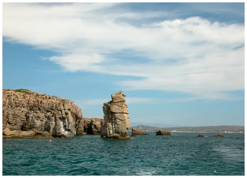

Viewpoint also affects what can be seen. From one angle, a pillar may overlap the cliff behind it; from another, the intervening water is clearly visible. Before attributing every apparent difference to erosion, compare orientation and framing. A calm surface reveals the foot of the rock differently from disturbed water. Historical photographs can prompt useful questions about the coast, but they are not substitutes for a geological survey or a present-day assessment of the site and its remaining structures.
How to read a natural pillar
The regional environmental portal identifies the rock as rhyolitic ignimbrite associated with Oligocene-Miocene volcanism. These are not constructed columns: the name describes their resemblance to pillars. Fractures and the arrangement of the rock in beds contributed to uneven erosion, leaving isolated elements in front of the coast. The SIRA description draws on a publication from 1996. It is useful for explaining the geology, but its measurements of two pillars must not be presented as a survey undertaken after the later collapses.
The historic images reveal lines dividing the masses into sections, interrupted edges and surfaces with different inclinations. Such details are more informative than simply calling the rocks impressive. They connect the outline with the material's structure, rather than suggesting an entirely uniform block. Comparing the coastal wall with an isolated stack makes a particular relationship visible: although water separates them, the pillar belongs to the history of that same coast. It is a remnant within a larger setting, not an unrelated object standing offshore.
A natural monument can still change
The regional portal refers to designation decree number 704 of 29 April 1993. Recognition as a natural monument gives the place a formal value; it does not stop the physical processes affecting it. The word monument may suggest permanence when applied to a building. Here it describes natural heritage whose changing form is part of its significance. The difference between the surviving place name and the altered outline makes Le Colonne an especially clear example of that relationship.
Official accounts also mention legends of petrified sailors and of Saint Peter turning sea monsters into stone. These are imaginative explanations and should remain separate from evidence about the rock and its collapse. Their value lies in showing how a recognisable silhouette can become part of collective storytelling. There is no need to choose one legend as a factual origin. Visitors can appreciate the stories while recognising that geological evidence and inherited narratives answer different kinds of question about the same place.

Approaching the viewpoint
Carloforte's tourism portal describes the southern approach along provincial road 103, referring to the car park at Bobba beach and a continuation on foot. Check local signs, route conditions and any notices before setting out. A general tourist description cannot establish that every section will be usable at every visit. Anyone with particular mobility requirements should ask about the final approach rather than inferring suitability from the apparent proximity of parking on a map. Road access and a coastal walking surface are different things.
From a permitted observation point, compare the cliff line with the remaining profile and then return to the dated photographs. There is no need to approach an edge or reproduce the angle of a picture taken from a boat. Le Colonne is above all a story of transformation: memory retains the paired pillars, sources document the loss, and the coast still offers relationships to examine. Holding those elements together produces a more meaningful visit than judging the place solely by its resemblance to an old postcard.