
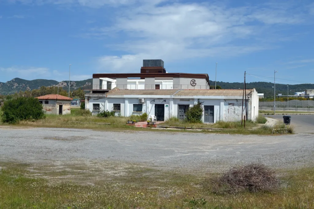

Carbonia's former Ferrovie Meridionali Sarde station belongs to a network that can no longer be travelled by train. Its building, photographed in 2023, retains a recognisable profile: a long, low body, a raised central section and a clock on the frontage. The open ground around it suggests the scale of a railway station, but these images show surviving structures rather than an operating railway facility. That distinction is central to understanding the place.
FMS stands for Ferrovie Meridionali Sarde. In Carbonia, the name identifies a history separate from that of the modern interchange. The Carbonia Serbariu directory entry is used here as a nearby geographic reference, not as the location of the historic FMS building. For present-day connections, consult the separate interchange article. This page concerns the physical legacy of the closed railway and its place within the mining city, rather than instructions for boarding a train today.
A network established before the new city
The Geomining Park records the opening of the FMS network on 13 May 1926, before Carbonia was founded. Its lines connected the Sulcis and Iglesiente with coastal shipping points and other railway nodes. The gauge was 950 millimetres: a technical measurement of the distance between the rails, not the length of a train. The system supported both passenger movement and the requirements of productive activities, bringing different transport needs onto the same infrastructure.

As the coalfield became more important, additional carrying capacity was needed. The Park's account records the start of double-track construction between Carbonia and Sant'Antioco harbour in 1939. That connection helps explain the station's economic purpose. Coal had to travel beyond the place where it was extracted to reach a shipping point. Rail transport formed one element in this logistical chain, linking inland production with movement by sea rather than treating the mine as an isolated workplace.
A building designed to be recognised
In the 2023 view, the raised central section interrupts the horizontal line of the side wings. The clock makes an essential part of railway life visible: the shared timing of departures, arrivals and work. It does not need to be functioning today for its earlier significance to be understood. Its position above the entrances still helps distinguish the structure from a residential building or a simple store, giving the frontage an identifiable public role.
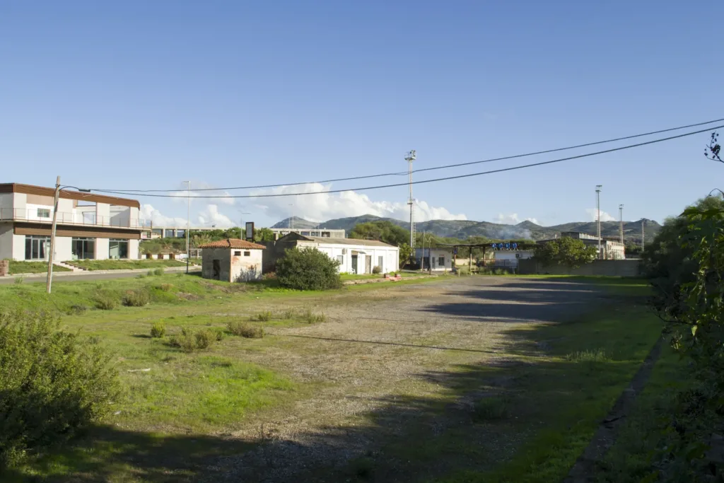
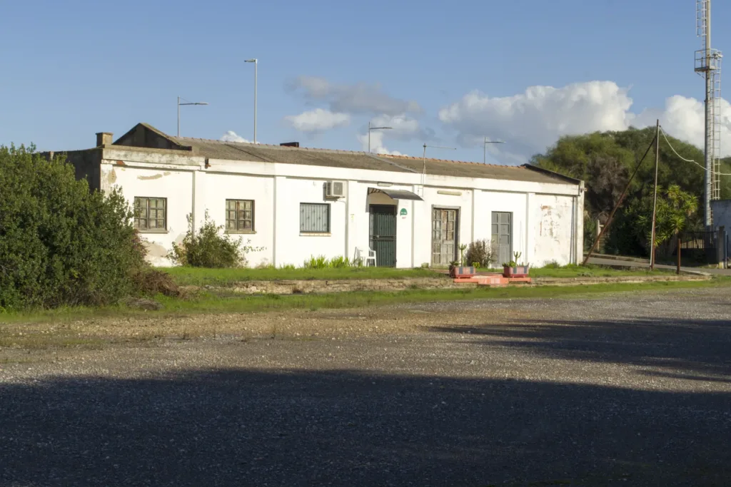
The 2021 photographs widen the view to the surrounding grounds. They show open surfaces, vegetation and additional structures, including a low service building with regularly spaced windows and broader openings. Comparing it with the principal building reveals that the station comprised more than one architectural element. It needed space for people, vehicles and different activities, even when the precise use of every room can no longer be identified from a present-day photograph of the exterior alone.
The trains stopped, but the company continued
The photographic documentation identifies the site as the former station on the San Giovanni Suergiu–Iglesias line, closed in 1974. The regional cycling-network description likewise places the route's closure in the mid-1970s. This should not be confused with the immediate disappearance of all FMS services: the company continued operating road transport. A railway name could consequently remain part of everyday life after trains had stopped running along the tracks associated with its earlier activities.
The old company website, which must be read as a historical document rather than a current timetable, describes interurban bus services and urban routes in Carbonia and Iglesias. It also records connections with stations and ferries. The source captures a later phase of mobility. Vehicles and organisation changed, while the need to connect settlements, workplaces and ports remained. Continuity of service did not necessarily mean retaining the same infrastructure or travelling along exactly the same routes.

Reading traces without inventing a route
Regional planning for the Carbonia–Gonnesa–Iglesias cycle itinerary treats the former railway alignment as a resource and describes sections already converted. However, the document is a planning instrument; it does not establish that every section is now completed, open or passable. Similarly, open ground beside the former station is not automatically a public route. Observe the buildings from permitted areas and do not enter the disused structures, whose appearance in photographs does not establish visitor access.
The most useful question here concerns the relationship between what survives and what is no longer visible. The clock, arrangement of openings and extent of the grounds suggest an organisation, but they cannot reconstruct the complete track layout by themselves. Comparing dated photographs with documentary sources makes it possible to recognise railway history without confusing it with current services. In this way, the former FMS station becomes tangible evidence of the movement that accompanied coal production.