
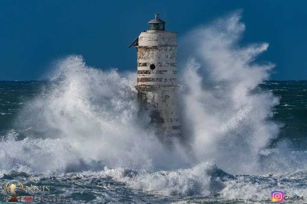

Mangiabarche is a place where a building that is tiny in relation to its surroundings becomes the focus of the landscape. The pale tower rises from low rock off the Calasetta coast, identifying a stretch of sea scattered with exposed outcrops. Photographs taken in rough weather can be dramatic, but calm water reveals the structure's purpose just as clearly. It gives mariners a recognisable reference above rocks that would otherwise present a much lower profile against the surrounding sea.
The Mangiabarche lighthouse directory entry identifies the rock carrying the light, rather than the coastal cliffs from which it is observed. Both form part of Calasetta's landscape on Sant'Antioco island. The map position identifies the subject; it does not indicate a pedestrian approach to the tower, which stands offshore. This account therefore begins with the relationship between an observer on land, exposed rocks and an isolated structure rather than with instructions for reaching the building itself.
A signalling tower rather than a defensive tower
Commonly called a lighthouse, the installation is classified by the Italian Navy as a rhythmic light serving as a maritime reference. Its published list number is 1348, and the activation year given is 1935. These details distinguish it from earlier military coastal towers. A vertical form beside the sea does not necessarily imply the same function. Here, the purpose is to provide a recognisable signal rather than to accommodate a garrison defending the surrounding territory from an approaching threat.
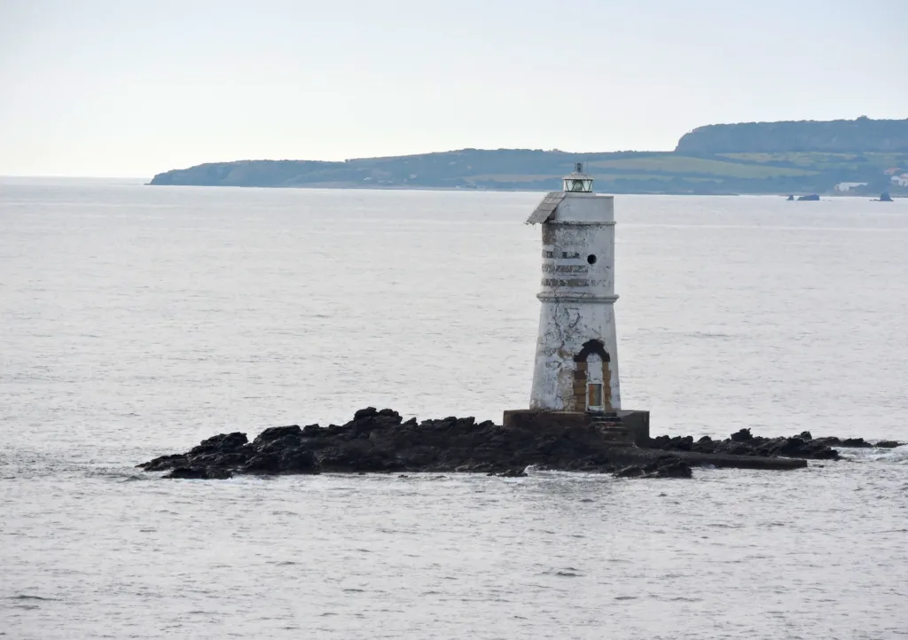

The official description identifies a white tapered tower ten metres tall, with the light twelve metres above sea level. Those measurements are not contradictory: one concerns the structure and the other the elevation of the light source relative to the water. For visitors, the distinction explains why descriptions of navigational installations contain more than one height. The landscape is measured according to the object's purpose, not solely by the dimension that appears most obvious in a photograph taken from the shore.
Understanding a rhythmic light
The same technical entry specifies a white light, a six-second period and photovoltaic power. These are identifying characteristics published by the responsible service. Rhythm distinguishes the signal from an unspecified light on the coast, while the power supply describes how its operation is supported. A daytime photograph cannot directly show the sequence of flashes, but it can locate the upper part of the structure from which the signal is emitted. Visible form and luminous character consequently provide complementary information about the installation.
This explanation is intended as cultural interpretation, rather than a replacement for updated nautical information. An online descriptive entry is not a real-time notice about the beacon's operational status. The distinction is useful even from land because it explains the Navy's separate lists and updates. A photographic landmark and a maritime device occupy the same object, but someone studying its appearance and someone relying on it while navigating require different kinds of information. Appreciating one role should not obscure the other.
Three photographs and changing conditions
The photograph with breaking waves shows how strongly the tower stands out when water partly conceals the rock beneath it. It records rough conditions, rather than promising that scene on every visit or encouraging anyone to approach the shoreline during a storm. The calmer view makes the relationship between the tower and its rocky platform more apparent. Together, the images show how the same structure can appear almost suspended among spray or clearly anchored to a low base surrounded by water.
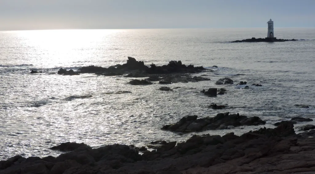
In the third photograph, nearer outcrops occupy the foreground while the beacon stands farther away. This arrangement reveals that the subject is not merely an isolated building, but a group of rocks and spaces between them. According to the regional tourism portal, the name Mangiabarche recalls the treacherous reputation of this stretch of coast. Specific shipwreck stories should not be added without documentation. The visible relationship between the marker and the outcrops already provides a concrete context for understanding the place name.

Watching from the Calasetta coast
Sardegna Turismo describes the location as rocky coast near Calasetta's beaches. The beacon's presence does not make it a landing place or create a walking route to the tower. Observe from permitted ground on the coast, taking sea and wind conditions into account. Distance forms part of the visual experience because it allows the rocks in front of the structure to enter the composition. Their relationship helps explain why a recognisable maritime reference was placed at precisely this exposed offshore location.
For a complete reading, move your attention between three elements: the white outline, its low rocky base and the water continually changing how both are perceived. Then compare what you see with the function described by the Navy. Mangiabarche becomes more than a tower to photograph at sunset. It demonstrates how a compact, purposeful structure can transform a low and less distinct feature into a recognisable sign within the maritime landscape, while preserving a clear connection between its appearance and the practical reason it exists.