
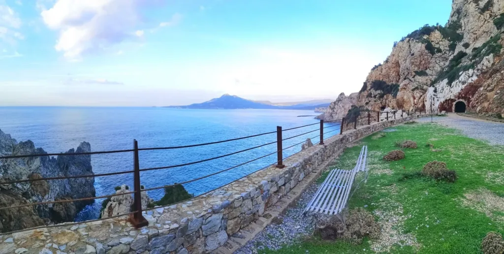

At the Henry Tunnel, the sea appears where a visitor might expect only a rock wall. The alternation between enclosed passages and cliff-side openings is the defining feature of this route above Buggerru. Yet the coastal views tell only part of its story. Before becoming a place from which to admire the sea, the tunnel was infrastructure for moving material. Reading it as an industrial transport line helps explain both its position and the substantial space cut through the rock.
The Henry Tunnel directory entry locates the entrance. The municipal tourism portal places the route above the settlement, through the Pranu Sartu plateau, and gives its length as approximately one kilometre. The map marker therefore does not represent the entire underground alignment. It provides an arrival reference, while the route continues through rock and beside the coast according to the arrangements of the organised visit. Entrance and complete itinerary are different things to keep in mind.
A line built to move ore
SardegnaCultura connects the Henry Tunnel with transport to the washing plants. This relationship is essential: extracting ore was only one stage, since material still had to reach the processing facilities. The passage connected separate functions within a productive system. Rather than treating it solely as a cavity in which to inspect marks left by excavation, consider what happened before and after a load passed through. Its usefulness depended on the wider sequence of operations beyond the tunnel itself.
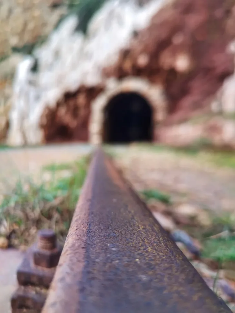

The photograph of a rail makes that idea tangible. Metal fills the foreground while an entrance remains blurred behind it, directing attention towards an alignment rather than details of the portal. Following the line visually turns the tunnel into a connection to be travelled. A single rail cannot establish the locomotive model or date every surviving part of the installation. It does, however, reveal the principle of repeated movement constrained to a defined track, instead of movement across an unrestricted surface.
From pack animals to a locomotive
Visit Buggerru associates the introduction of a steam locomotive in 1892 with the tunnel’s dimensions. SardegnaTurismo describes rail transport replacing the use of pack animals. The change concerned more than travelling faster. A railway needed room for vehicles and loads, a continuous alignment and coordinated operations. The shape of the excavation can be read as a response to those requirements. Its size becomes meaningful when considered alongside the transport task, rather than simply as an impressive underground space.
Keep the historical machinery separate from equipment used for visitors today. The regional page describes an outward journey by electric train and a return on foot. That does not mean the original mining locomotive operated in the same way. The distinction explains the purpose of the visitor route: former working infrastructure has been adapted to make it understandable to the public. Check the programme currently offered before booking, since a general description does not confirm the arrangements for every date.
The cliff becomes part of the story
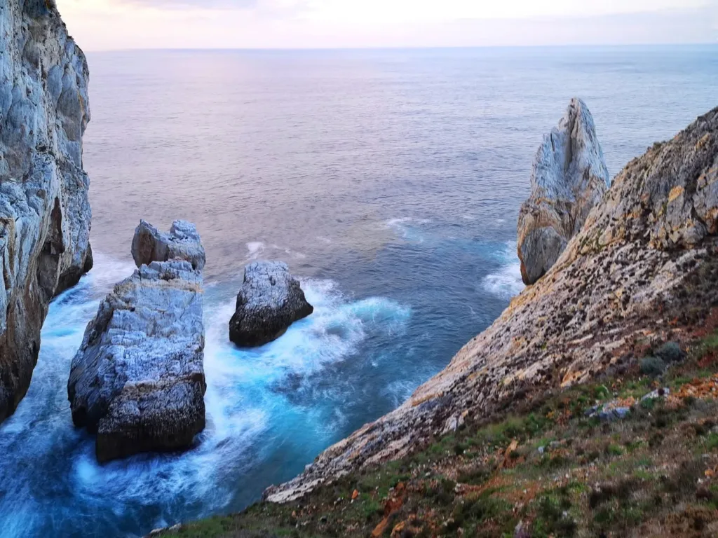
In the cover image, the outside walkway runs beside a parapet and rock face, with a dark opening visible further ahead. The sea suddenly expands the field of view. The third photograph looks down towards water surrounding rocks separated from the cliff. Together, the images show how the experience changes between the narrow scale of a passage and the much wider coastal setting. Both belong to the same transport landscape, even though they produce very different visual impressions.
These views should not be used to identify shortcuts or ways down to the rocks. Appreciate the connection with the sea from permitted areas while following the guide’s directions. A photograph cannot reproduce the full perception of distance and slope: an opening may appear closer to the water than it really is. Recognising the height difference between the route and the coast below is part of understanding the panorama. The viewpoint matters as much as the forms seen beyond it.

Planning the approach from Buggerru
Consult the Buggerru tourism portal for booking and arrival information. It states that the ticket office is reached on foot from the village and mentions steps on the approach. Consider this before deciding how much time to allow, especially if anyone in the group has mobility requirements. Ask the operator for current guidance. The presence of a visitor train does not establish that the whole approach is step-free or suitable for every individual need.
One question provides a useful thread through the visit: how was extracted material moved? Rails, passage dimensions and connections with processing plants provide answers that a sequence of scenic viewpoints alone cannot give. The Henry Tunnel brings together two readings of one place: a transport structure and a route opening onto the coast. Keeping both in view makes the Buggerru cliff understandable as part of an organised industrial landscape, while preserving the pleasure of observing its rock, water and changing light.