
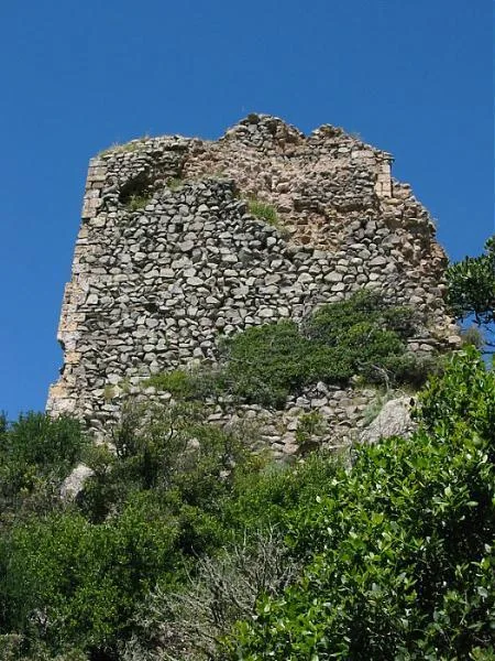

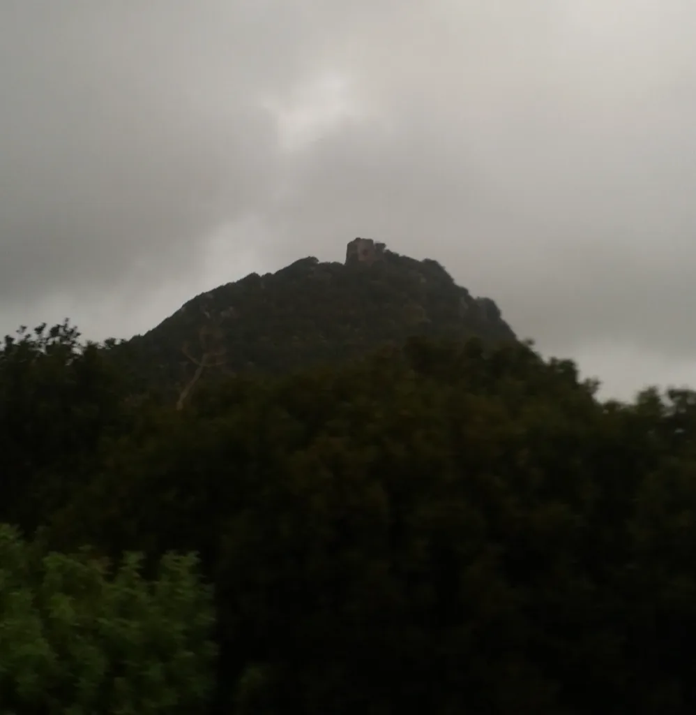
Gioiosa Guardia Castle in Villamassargia can first be read in the outline of its hill, then in its surviving masonry. From a distance, the ruins seem a small interruption along the summit. In the closer photograph, the texture of the stones and the height of the remaining sections become much more apparent. This change of scale is a useful starting point: the fortification belongs to a particular landform, and its position matters as much as the surviving traces of its rooms.
The Gioiosa Guardia Castle directory entry identifies the monument within the territory of Villamassargia. The name occurs elsewhere in Italy, so the location matters: this is the Sardinian castle, not the similarly named site in Sicily. The directory map helps distinguish the place and prepare your orientation. A geographical point does not, however, describe a walking route. The approach needs to be checked separately from the coordinates of the ruins themselves.
A medieval fortress preserved in fragments
The National Archaeological Museum of Cagliari places the construction in the thirteenth century and describes several identifiable components: outer spaces associated with the guardhouse, a tower and a rainwater cistern. The same source explains that destruction makes the arrangement of some rooms difficult to reconstruct. This is a significant qualification. A missing wall does not necessarily indicate an originally open area, and today’s remains cannot provide a complete account of the medieval layout without gaps.

When examining a ruined fortification, it helps to distinguish what physically survives from what researchers reconstruct. The stones preserve material evidence, while the functions of spaces require interpretation supported by study. The cistern also raises a practical question about the use of the position: how could water be supplied to people stationed high on the hill? There is no need to invent a particular siege or military episode to appreciate why collection and storage mattered to the functioning of the site.
How the hill changes the meaning of the walls
The silhouette photograph shows vegetation on the slopes and an irregular summit against which the remains are only faintly distinguishable. Its viewpoint emphasises the vertical relationship between the lower ground and the structure above. Seen from this distance, the fortress reads less as a collection of rooms than as a presence in the landscape. Approach, visibility and separation from the surrounding ground become questions that can be considered before recognising any individual architectural feature.
The regional Geolav project associates the castle with a path from the S’Ortu Mannu area. This connects the ground below the hill with the summit, without making them equivalent destinations. The olive grove has its own story, explored in the Villamassargia article archive. Here the focus remains on the hill and fortification. Reaching the area beneath the ruins does not mean that the approach to the castle has been completed, or that the remaining ascent follows the same conditions.
Looking carefully at surviving masonry
In the close view, the preserved surfaces have broken edges and a fabric of differently shaped stones. Light reveals projections and recesses, while plants obscure the base. These details help explain the fragmentary condition of the monument, but they do not provide a structural assessment. A photograph cannot establish the stability of a wall, the thickness of every section or whether it is safe to pass behind a part that remains outside the frame.
Observing from a permitted route, without climbing the masonry, also preserves the quality of the evidence. A ruin does not become an equipped viewing platform simply because its position suggests a wide panorama. Displaced stones and irregular edges belong to the material history of the site. Leaving them undisturbed preserves relationships that may be useful to researchers studying the building and its transformations, while allowing visitors to appreciate the surviving structure on its own terms.

A document from 1358 and a visit today
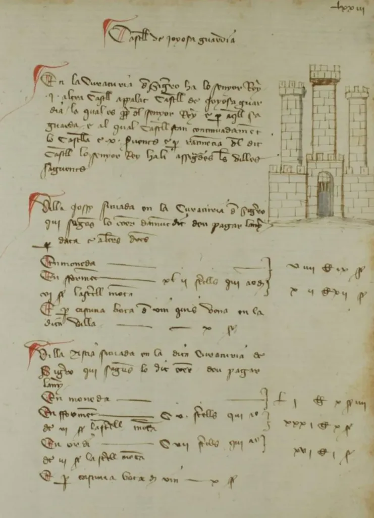
The illustrated page from the Compartiment de Sardenya, dated 1358 in the Commons collection, offers a different comparison from the photographs. A drawing of the castle sits beside writing and condenses the idea of a fortified structure. It is a historical document, not a photograph of the intact building or a measured architectural survey. Comparing it with the ruins helps distinguish different ways of representing a place; it does not permit an exact reconstruction simply by copying the drawing.
Before planning the ascent, check local information about the route and access conditions, taking account of terrain and weather. The Geolav page describes an area affected by maintenance, but that general statement cannot certify the condition of the path on your intended day. Gioiosa Guardia’s interest lies in the relationship between position, construction and documentation. These complementary perspectives make the castle understandable while leaving room for the uncertainties that still surround parts of its history and original appearance.