
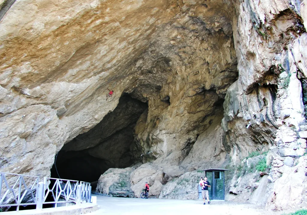

At San Giovanni Cave in Domusnovas, a road enters the mountain and reaches another natural opening. That arrangement changes the experience of being underground: the subject is a crossing rather than simply a chamber. The regular surface of the route and the irregular cave walls belong to different histories, one natural and the other infrastructural. Their meeting gives the place its identity and explains why a cave could also serve as a practical connection between territories outside it.
The San Giovanni Cave directory entry locates the attraction in Domusnovas. It should not be confused with the San Giovanni mine near Iglesias or with Santa Barbara Cave. Those are separate places, despite names that can cause confusion during online searches. Here the subject is the large natural passage containing a road, with a southern entrance towards the town and another opening towards the Oridda valley on the opposite side.
Two openings connected by a passage
Sources give slightly different measurements for the main route: approximately eight hundred and fifty metres in the regional description and eight hundred and sixty on the operator's website. The useful idea is a passage approaching a kilometre in length, not a short entrance chamber. Its winding course cannot be reduced to a window immediately revealing the opposite end. The connection becomes understandable through movement and the changing relationships between the road surface, surrounding walls and available light.
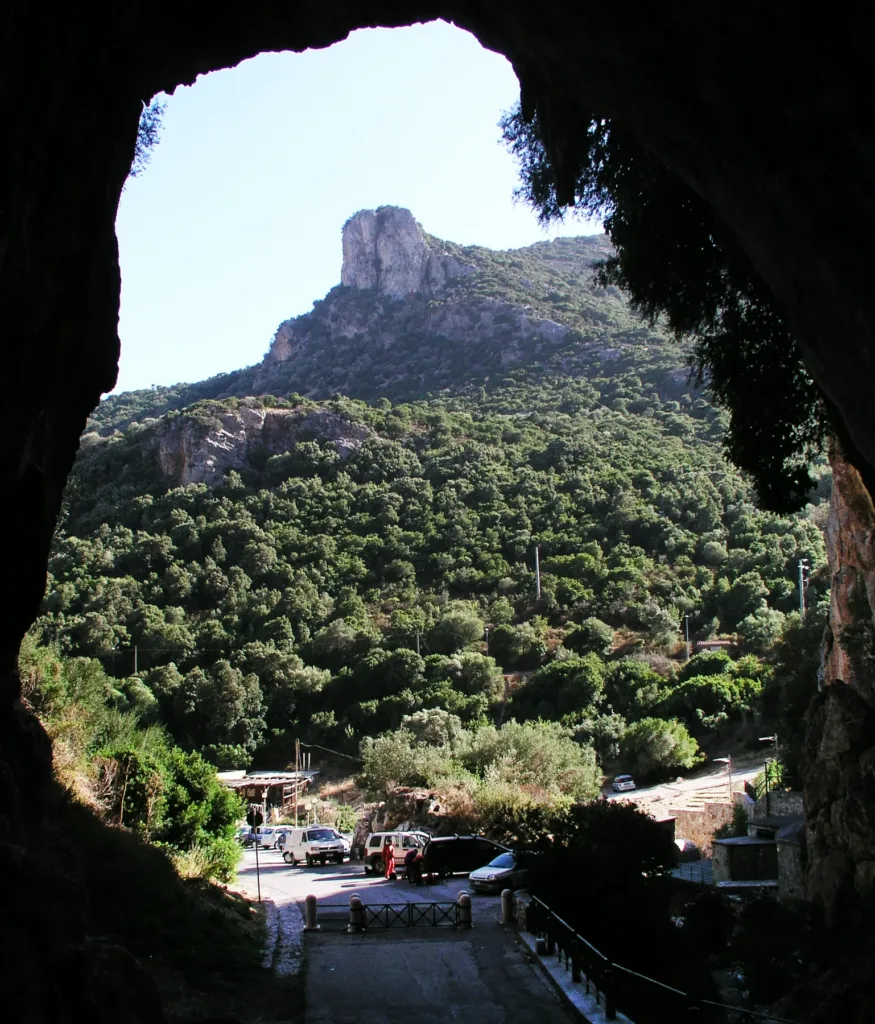

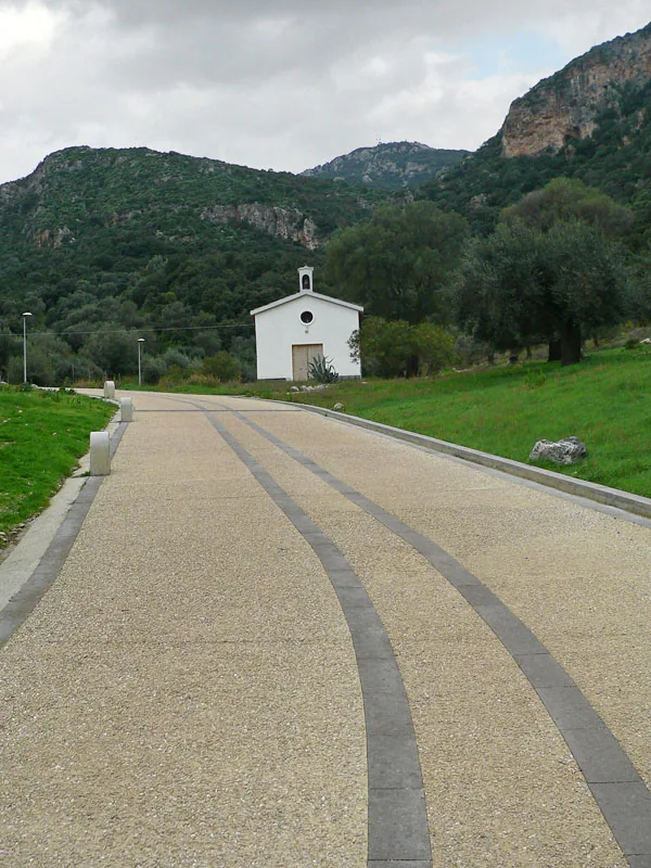
One historical photograph reproduced here looks out from inside, with the dark edge of the cave framing vegetation and distant rock. Another shows the scale of the vault near an entrance. Both images date from 2010 and do not establish the present arrangement of visitor facilities, but they clearly convey the size of the natural opening relative to people. The exterior approach photograph, taken in 2009, places the threshold within the surrounding landscape rather than treating it as an isolated underground object.
A road connected with mining
The operator records that construction of the internal road began in 1866 through the initiative of Count Pietro Beltrami and was later completed by Gaetano Semenza. Its purpose was to improve connections between Domusnovas and mining activities in the Oridda valley, making mineral transport easier. It was therefore not originally designed as a scenic promenade. The regular route answered an economic need whose material trace remains especially clear when compared with the natural surfaces beside and above it.
According to the operator, the road remained open to motor vehicles until 1999; regional accounts associate that period with protection as a natural monument. Its historical use by vehicles does not mean that visitors can now drive through it. The description concerns a former condition and a physical characteristic, not current permission. Keeping those meanings apart is particularly useful when older images and accounts remain accessible online and can otherwise be mistaken for instructions applicable to a visit today.
Water and the shape of the cave
The regional description relates the cave to the San Giovanni stream and karst processes within carbonate rock. The visible result does not have the geometry of a tunnel excavated specifically for a road. Instead, the route occupies a broader natural volume whose dimensions vary. Compare the edges of the roadway with the vault above to distinguish human adaptation from the shape of the mountain. The two are closely connected here, but they are not products of the same process.
The underground system also extends beyond the main crossing. The operator identifies branches named Su Stampu de Pireddu and Bobore and reserves secondary passages for experienced cavers. An ordinary visit should therefore not be confused with exploration of the complete system. This distinction matters because the road can create an impression of general ease. A convenient surface in one part of a cave says little about the conditions of side passages opening nearby or extending beyond the visitor route.

From transport link to visitor attraction
Present admission is organised through specific visiting arrangements. The operator's website distinguishes independent, interactive and guided visits, with different tickets. It also sets separate conditions for cyclists and runners. A free-entry label on a general tourism page should consequently not be taken as an accurate description of the current service. Before travelling, check the type of experience selected and the most recent notices rather than assuming that historical passage through the cave remains unrestricted.
Published hours may also differ between seasonal pages and language versions. Confirmation from the operator is preferable to repeating an undated timetable. Visitors with mobility requirements should ask for specific information about the route and available arrangements. Cyclists need to check the dedicated passage window instead of extending that option automatically to the whole day. These checks help select a suitable visit; they are not a reason to replace the experience itself with a complicated set of assumptions.
San Giovanni is best understood through three connected features: its natural openings, the road developed for transport and the contemporary organisation of visits. The small church near the southern entrance, visible in the exterior photograph, remains a landmark associated with the setting and name without becoming the subject of this route. The mountain crossing instead raises a central question: how does a natural space change when it becomes infrastructure and later heritage? Here, the relationship between paved surface and rock preserves a particularly direct way of considering that question.