
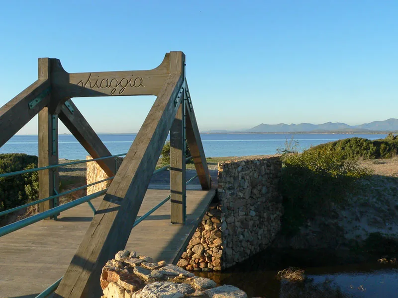

Is Solinas is a beach in Masainas facing the Gulf of Palmas, but reaching the water involves a landscape more varied than a single strip of sand. In photographs of its approaches, timber walkways guide the eye between vegetation and pale ground towards the sea. Lagoons also form part of the surrounding coastal environment. This combination of shoreline, access routes and wetlands gives the place its character before a visitor even decides where to settle on the beach for the day.
Use the Is Solinas beach directory page for orientation. SardegnaTurismo places it within Masainas, south of nearby Porto Botte, and also records the name La Salina. Municipal documentation uses Is Solinas–Sa Sarina for the designated stopping area. These names help connect references across different sources. They should not lead to confusion with other Sardinian beaches whose names also refer to salt production or saltwater landscapes. The municipality provides an essential geographical distinction.
The water appears beyond the approach
The cover photograph records an access structure in 2008. Timber beams create a distinct frame in front of the sea, while a stone wall defines one side. The interesting feature is the change of scale: nearby boards and supports give way to an open waterline and distant land. Rather than simply showing sand colour or confirming that the sea is present, the image explains a way of approaching the shore. The transition from enclosed passage to broad view becomes part of the place.
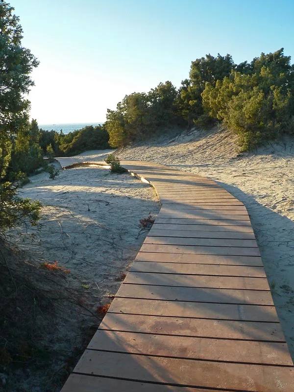

The second photograph, also from 2008, shows a curved boardwalk among the dunes. Its direction responds to the ground and vegetation instead of crossing them in a straight line. Both images are historical records of access arrangements, not confirmation of the structures’ condition today. Their dates therefore remain visible in the captions. A photograph can help explain how a location was organised while still requiring a current check before being used as practical guidance for a visit.
A beach associated with wind sports
The regional tourism record presents Is Solinas as a destination for kitesurfing and windsurfing and describes a seabed that deepens gradually away from shore. These characteristics explain the bay’s sporting appeal, but they do not predict conditions on any particular day. Wind, sea state and activities already taking place affect how the space is used. Before entering the water, assess the actual situation and local signs, including any distinction between bathing areas and areas allocated to launching or manoeuvring equipment.
Even for visitors who do not practise these sports, sails help make the landscape understandable. They reveal air movement that a photograph of calm water can conceal. Choosing a comfortable place to stop involves considering exposure to wind as well as the view towards the sea. A picture taken during favourable conditions cannot promise similar calm throughout the year. Is Solinas is better approached by matching the day to the intended activity, whether swimming, watching the coast or spending time beside the water.
The lagoon photograph widens the view
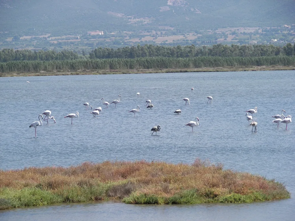
The regional tourism portal connects the setting of Is Solinas with the Porto Botte and Baiocca lagoons and their birdlife. The third image shows flamingos in Porto Botte lagoon in 2009. It records the nearby environment, rather than the beach itself, and does not establish that the same birds will be present during a future visit. The geographical focus of this article remains the Masainas beach. The lagoon image helps explain the broader setting surrounding that specific location.
In the photograph, birds occupy shallow water, with an open stretch separating them from the bank. Distance is part of the scene and can remain so during observation. Binoculars make it possible to notice posture and movement without moving closer. There is no need to follow birds in an attempt to reproduce a photograph. The interest of a wetland does not depend on identifying the largest number of species within a few minutes, but on noticing relationships between water, margins and changing animal presence.

Planning facilities and access separately
The municipality publishes rules for the Is Solinas–Sa Sarina stopping area. Consult these alongside current notices if you intend to use that facility. A published regulation does not independently confirm availability, charges or services on a particular date. Likewise, a boardwalk visible in an older photograph is not a current accessibility assessment. Ask about the condition of the approach if anyone in the group has requirements that depend on a particular surface or route.
A day at Is Solinas can therefore be organised around three distinct stages: approaching through permitted access points, selecting a place beside the sea and observing the wider environment without entering sensitive wetland areas. The photographs support that reading through thresholds, curves and distances. Together they offer a more precise understanding of this beach: a particular stretch of the Masainas coast, with its own names and geographical references, set within a larger environment that rewards time and careful attention.