
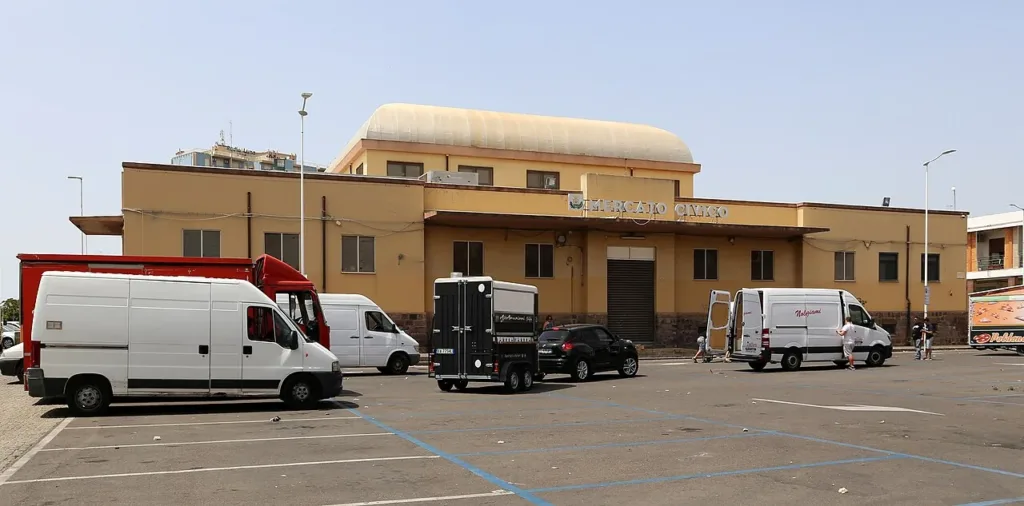

Carbonia's civic market occupies a recognisable position in Piazza Ciusa. It is a low, compact building with a taller volume set back at its centre and a frontage announcing its function. The square provides enough distance to see the building as a whole and consider the spaces needed to arrive, stop and distribute goods. Architecture here can be approached through a very practical activity: the everyday exchange of products.
The civic market directory entry locates the building directly on Carbonia's map. The photographs used here date from June 2019. They document the market frontage and a commercial edge of the square, without establishing which businesses operate today. If you are looking for a particular product, check the relevant business and its hours beforehand. Identifying a historic building is different from providing a current list of open stalls.
A compact square within the square
Italy's General Catalogue of Cultural Heritage describes a square plan measuring approximately forty metres on each side, with an upper central volume set back from the edges. Exposed stone appears at the base, while the surfaces above are rendered. The combination creates a visibly textured lower section beneath a more uniform upper body. Those measurements concern the building itself, rather than the whole piazza or the space allocated to individual traders.

The frontal photograph reveals repeated openings, a change in level from the surrounding space and the name above the entrance. That sign is part of how the building communicates: it connects a relatively restrained exterior with an immediately understandable public purpose. The recessed upper volume also marks the centre of the composition without turning the entire frontage into a tall elevation. Its overall character remains horizontal despite the clearly differentiated upper section.
The market and its commercial surroundings
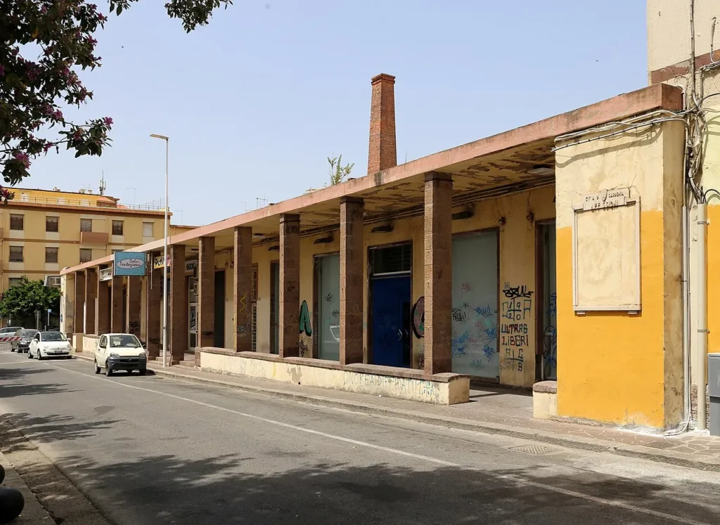
The second photograph shows a portico along a commercial frontage facing the square. It is not an interior view of the market. Its supports, thresholds and openings describe the relationship between premises and the outside route. Comparing the two photographs helps separate the civic market building from the broader commercial setting. Piazza Ciusa includes the edges from which the central building is approached and observed, as well as the building itself.
Beneath the portico, supports divide the frontage into successive bays; in front of the market, open space allows a much wider view. These are different ways of arranging encounters between people and businesses. Compare depth, shade and distance: the linear shelter beside the commercial premises contrasts with the freestanding central volume. The photographs establish these spatial relationships without requiring invented descriptions of products, prices or conversations on a day that has not been documented.
A historic map changes the scale
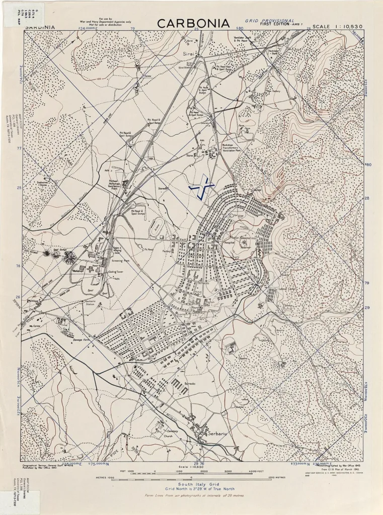
The 1943 plan of Carbonia produced by the United States Army Map Service broadens the view to the town around the market. Reproduced as the third image, it is a historical document rather than a map for present-day navigation. Streets and built-up areas make it possible to compare the scale of an individual building with that of the settlement, recalling that a place for obtaining supplies operates within a wider urban network.
Use the portal's interactive map for orientation today. The old plan helps raise questions about context, but it cannot establish current entrances, traffic directions or parking availability. The 2019 photographs also belong to their stated date: parked vehicles, shutters and the condition of facades record those particular moments. Keeping these types of evidence separate makes comparison between document, building and contemporary use of the square more informative and more reliable.

What the 2026 programme proposes
On 20 March 2026, the Sardinian regional government announced approval of an urban strategy for Carbonia including new uses for the civic market and improvements around Ciusa, Matteotti and San Ponziano squares. The allocation of €12.29 million concerns the complete strategy, not the market alone. Business support and participation are also included. Approval does not establish that every construction project has been completed or that all the proposed services are already operating.
The municipal Commerce and Crafts service is an institutional reference for enquiries about economic activities. Exploring Piazza Ciusa therefore brings together three concrete subjects: the shape of the market, its relationship with neighbouring commercial frontages and a public programme whose implementation requires subsequent updates. The square offers a particular perspective on Carbonia, centred on places built for exchange, supplies and the encounters associated with everyday urban life.