
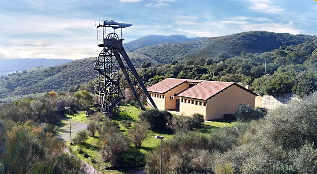

A rock specimen, a mountain reproduced at reduced scale and a surface of shapeable sand can explain a landscape in different ways. At Museo GeoPunto in Genna Luas, Iglesias, these tools belong to a route through the Earth sciences. The visit becomes interesting through changes of scale: from a specimen revealing its structure to a representation of the whole of Sardinia, and then to a miniature landscape that responds when a visitor alters its shape.
The museum stands outside the urban centre, within the former mining area. The GeoPunto directory entry locates the site and provides the geographic reference for this article. In the exterior photograph supplied by the museum in 2024, the low building appears beside the Pozzo Morra headframe. Their relationship introduces the subject before any display case: this is a place retaining a material connection with underground work, rather than an exhibition detached from its surroundings.
A museum shaped by its mining setting
ISPRA records the foundation of the Museum of Mining Work in 2001 and the preservation of the Pozzo Morra headframe and winding machinery. The current operator, the Association for Sardinia's Historical and Environmental Geomining Park, presents GeoPunto as a place for learning without requiring specialist knowledge. Industrial heritage supplies the setting, while the displays invite visitors to understand materials and processes underlying the landscape. The two aspects give context to one another throughout the visit.
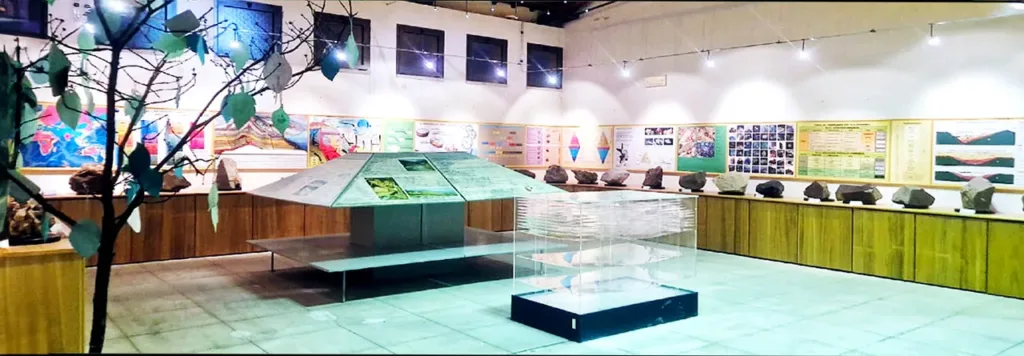

The interior photograph shows specimens, panels and territorial representations sharing the same room. They should not be treated as interchangeable objects. A specimen is a portion of material, a model reduces and selects forms, and a panel organises information. Asking what question each tool can answer helps establish a route through the display. Understanding the structure of a rock requires a different kind of attention from comparing the positions of two hills within a larger area.
Looking at two faces of a rock
The museum's description of its petrographic section, published with its own photographs, explains that blocks combine a cut surface with a face exposed to natural erosion. This comparison is useful: the exterior records contact with the environment, while the cut makes the structure easier to examine. Colour and appearance should not be expected to match perfectly on both faces. Their difference suggests how strongly a surface can influence the first impression and subsequent identification of a specimen.
Start by considering the size of visible components, their distribution and whether different zones can be distinguished. Then compare those observations with the label and the guide's explanation. Assigning a name immediately, based only on colour, can bypass the most interesting step: learning which features provide useful evidence. GeoPunto offers a setting in which a first impression can become a question that can be checked, instead of remaining an unsupported guess about what the material might be.
Sardinia as a three-dimensional surface
According to the museum, its relief model of Sardinia was produced with a computer-controlled milling tool using elevation data. The resulting surface can receive projected thematic maps. The relief stays in place while the information changes, allowing geology, vegetation and other distributions to be compared. This distinguishes the island's physical form from the different phenomena selected for representation on a map, making it easier to understand why several maps of the same place can look different.
A simple exercise is to locate Iglesias first, then follow the transition between the coastline and the interior. When a theme is projected, try describing a specific relationship between shapes and colours without assuming that every coincidence establishes a cause. The model encourages comparison. Its three-dimensional surface provides a shared reference both for visitors familiar with the island through travel and for those who have encountered it mainly on maps, helping connect different kinds of geographic experience.

Shaping a landscape in the sandbox
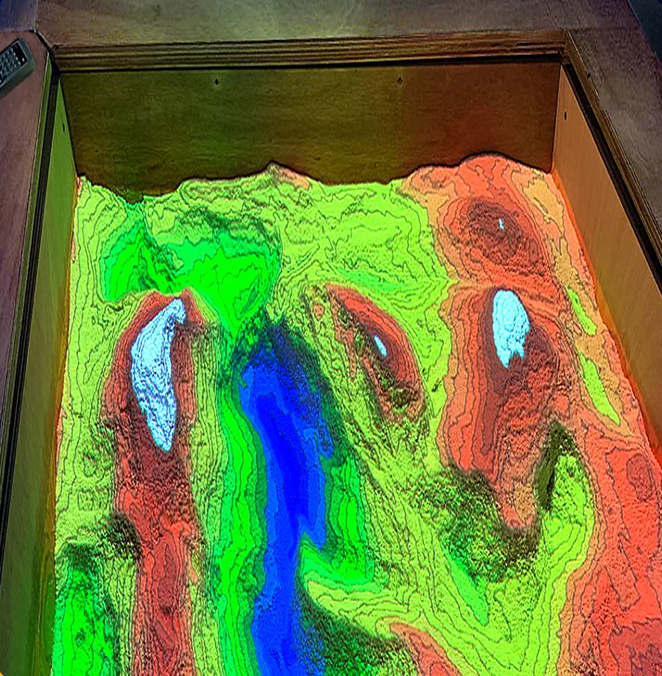
The sandbox combines sand, a sensor, a projector and a computer. Moving the material changes its height, and the system updates colours and contour lines across the surface. The museum's explanation also describes simulated water collecting in depressions. Blue areas in the photograph belong to the projection; they do not document real water in the box. Recognising that distinction helps explain the device's purpose: it makes relationships visible that can be less immediately apparent on a fixed map.
Before travelling, contact the museum through the operator's website to arrange access and check available activities, particularly for a demonstration or school group. The photographs document the 2024 displays and do not guarantee that every device operates daily. A useful lesson to take away is to examine the material, identify the scale and distinguish a landscape from its representation. These are three different operations that can then be applied to the wider Iglesiente landscape.