
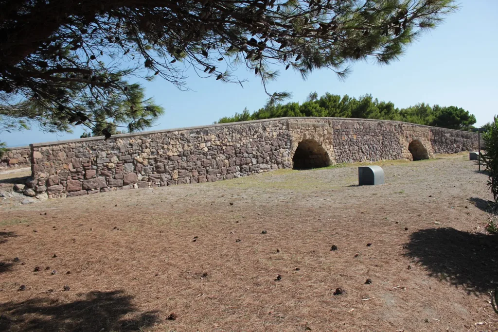

Sant'Antioco's Roman Bridge now appears modest beside the roads and traffic at the entrance to the island. Yet Su Ponti Mannu, the Great Bridge, reveals an important geographical problem: maintaining a land connection across a lagoon environment. Viewing it only as a pair of old arches misses the most interesting aspect of its history. The surviving monument belonged to a system of crossings, stretches of road and intermediate points that together made movement across this changing landscape possible.
The Roman Bridge directory entry identifies the historic structure near the approach to Sant'Antioco. It should be distinguished from the modern road bridge and from the nearby small harbour that shares its name. In the overall photograph, the ground beneath the arches appears dry. This records conditions when the image was taken; it does not establish that the bridge was always unrelated to water. Understanding it requires attention to the geography of connections as well as to the walls themselves.
A road across a chain of islets
The municipal tourism portal places Su Ponti Mannu on the road linking Karalis, ancient Cagliari, with Sulci. In its final section, the route crossed the area of the Santa Caterina lagoon using islets and constructed passages. The task was therefore more complicated than spanning a river with a single bridge. Builders needed to maintain a land route towards an island town, adapting the connection to surroundings where exposed ground and water alternated. The surviving structure is evidence of that wider arrangement.
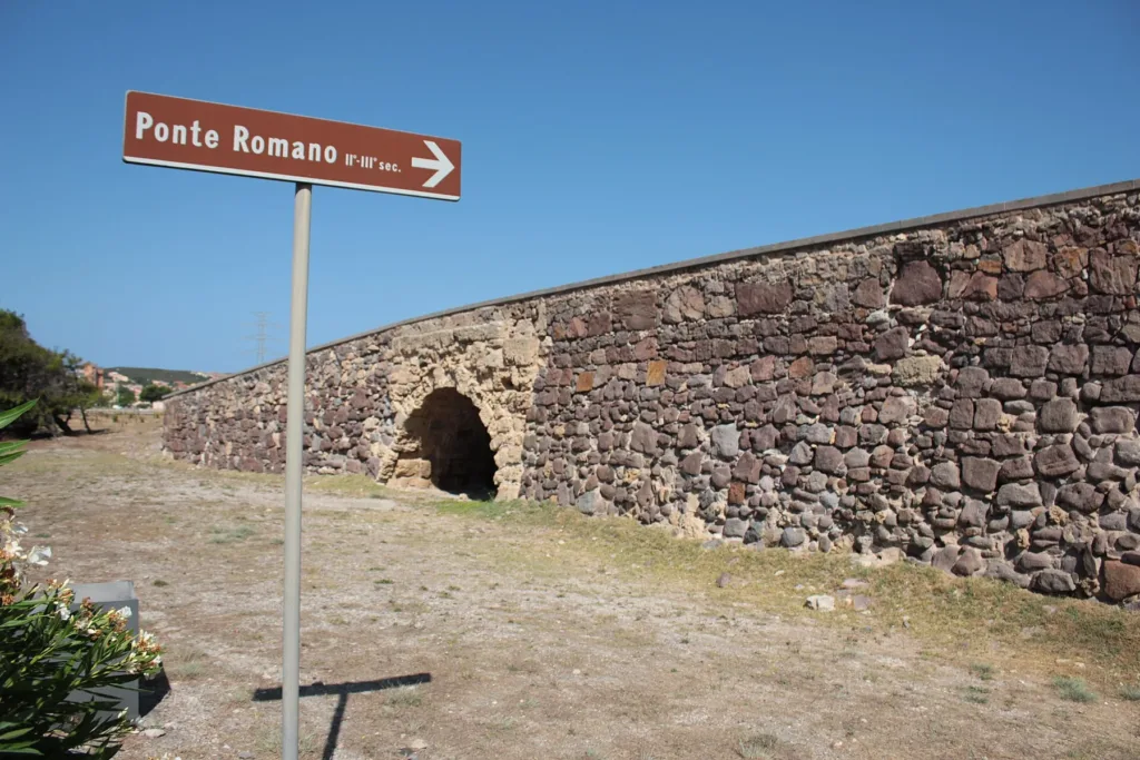

This relationship also explains the monument's scale. Its remaining arches should not be imagined as the whole connection between today's shores. They belong within a longer sequence. The official Levante itinerary also mentions partly submerged road remains that are easier to recognise at low tide. That information is neither a guarantee of daily visibility nor a suggestion to enter the water looking for them. Its value here is to show that bridge and road formed connected parts of the same infrastructure.
A Roman name and later alterations
The traditional name preserves the connection with ancient infrastructure, but it cannot date every visible stone. In its account of Sardinian bridges, Virtual Archaeology describes the Sant'Antioco structure as built above Roman remains and explains how repeated repairs and rebuilding complicate identification of original fabric. This distinction matters. The monument does not have to be completely unchanged to remain historically valuable. Its alterations also record the continuing need to maintain a crossing over a very long period of use.
Visit Sant'Antioco mentions documented work from 1774 and further interventions during the nineteenth century. It is consequently more accurate to discuss a structure with an extended history of repair than to assign all its masonry to one moment. Photographs reveal differences in the arrangement of stones, but cannot replace archaeological recording. Comparing visible evidence with what published sources actually establish makes the bridge more informative than a single, overly simple date attached to every surface or architectural detail.
Three ways to look at the arches
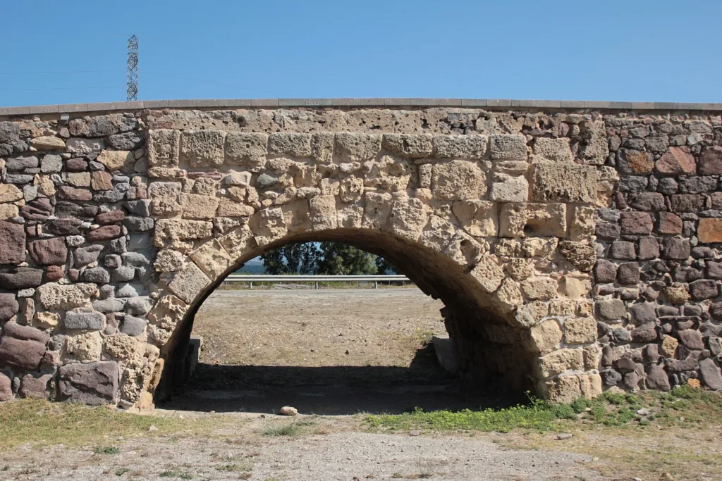
The wide photograph reveals the elongated form of the structure and its two openings. The image containing the visitor sign shows how the historic monument is identified within a contemporary setting. A closer view of an arch allows comparison between blocks around the curved opening and stones in the surrounding wall. These are different scales of observation: first the monument in its surroundings, then its public presentation, and finally the construction of an opening through a substantial mass of masonry.
The empty space beneath an arch matters as much as the stones above it. It makes the crossing function understandable without requiring an elaborate imagined reconstruction. The photographs also include trees, roads and modern infrastructure nearby. This is not an ancient bridge standing in surroundings frozen in antiquity. The proximity of different periods is part of its interest. Traffic still reaches the island, while the older structure retains evidence of a previous solution to the same practical need for connection.

A stop focused on movement
Use the directory position and signs on site to identify Su Ponti Mannu, choosing permitted pedestrian approaches rather than stopping on the carriageway. A visit can have a clear focus: examine the arches, then widen your view to take in the lagoon setting and today's transport route. Climbing on the walls is unnecessary for understanding their form. Official information and observation from ground level are enough to distinguish the historic bridge, modern road and landscape that both were intended to cross.
Before leaving, mentally assemble the sequence of islet, road, arch and another patch of exposed ground. This provides a concrete way of considering the relationship between Sant'Antioco and the rest of Sardinia. Su Ponti Mannu represents continuity through maintenance and adaptation rather than an object preserved outside time. Connection remains its central subject: people and routes change, but the need to reach the island continues to shape this part of the landscape and gives the surviving arches their wider significance.