
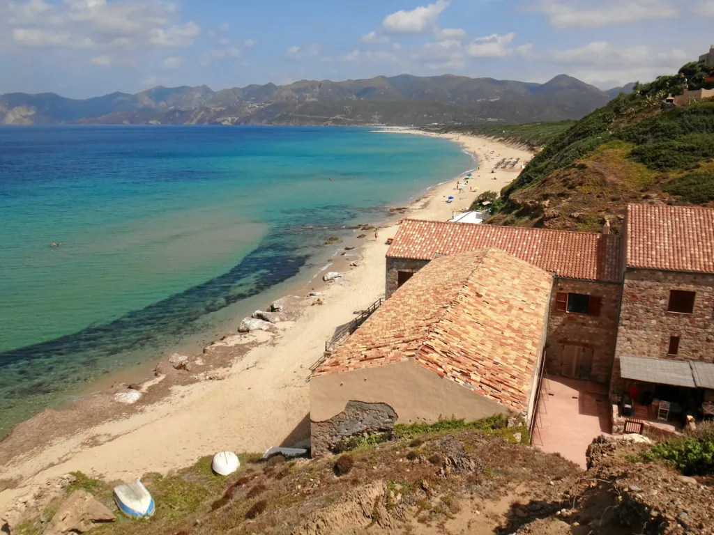

At Porto Paglia, Gonnesa’s coastal landscape can be understood through an immediate contrast: a long, open beach on one side and the buildings of the former tuna-fishing settlement on the rocky edge of the other. These are connected parts of the same place. The position of the complex explains how work at sea shaped this section of coast, leaving an identifiable footprint after the buildings acquired new uses. Begin with that relationship between housing, elevation and shoreline.
The southern end of Gonnesa’s beach
Porto Paglia names the southern section of the broad beach along the marina of Gonnesa. SardegnaTurismo distinguishes four access areas along a substantially continuous sandy shore: Porto Paglia, Punta s’Arena, Plag’e mesu and Fontanamare. This distinction matters when choosing a destination on a map. A general search for Gonnesa’s coast will not necessarily bring you beside the old tuna complex. The Porto Paglia beach listing identifies the location associated with this article.
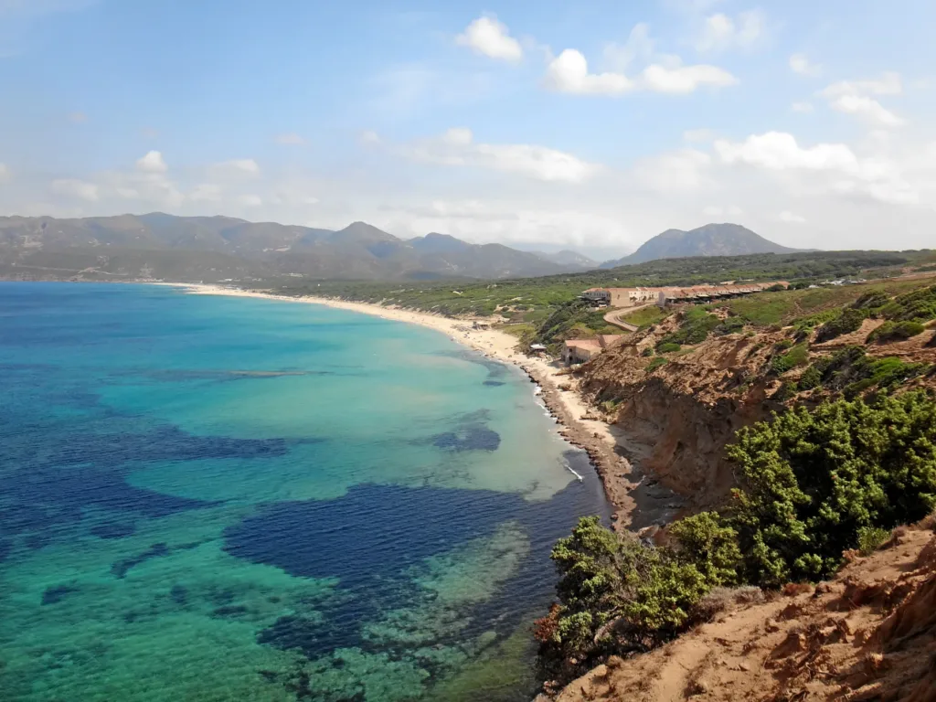
In photographs, the headland and roofs create a diagonal line against the water’s edge. Looking north, the beach continues and the scene expands. Comparing these views is a useful way to approach the place: the built detail describes a settlement, while the wider view explains the continuity of the shore. To photograph their relationship, include some of the beach alongside the buildings, while observing access restrictions and respecting private property.

A fishing concession is not a building date
The history of fishing here reaches further back than a simple eighteenth-century date for the complex might suggest. The University of Cagliari’s digital maritime history atlas records a concession to Nicolao Pintor in 1595. It then traces changes in management and ownership, including acquisition by Carpaneto and Ghillino in the nineteenth century. Reading these sources requires a distinction between the economic activity, rights over the fishing waters and successive phases of the buildings on land.
A tonnara was therefore more than a house beside the sea: the term belonged to an organisation of labour. Keeping this in mind avoids assigning the oldest date found in a document to every surviving wall. The national architectural catalogue places the complex within the eighteenth to twentieth centuries, while historical documentation follows a longer story. These records answer different questions and can be used together without forcing them into a single construction date.
Homes, storage and the organisation of work
The Ministry’s architectural record, compiled in 1978, describes a U-shaped arrangement on a coastal terrace. It identifies nine terraced houses for tuna workers and two-level homes associated with the rais and boat leaders. Entering private spaces is unnecessary to appreciate the significance of this information. Differences in height, repeated housing units and position beside the coast turn the allocation of jobs and responsibilities into a pattern that can be studied through architecture.
The same inventory records storage buildings, a chapel and a fountain with an underground cistern in the internal space. These features indicate that seasonal fishing also required provision for supplies and everyday life. The catalogue’s date is important: descriptions of deterioration observed in 1978 should not be presented as an assessment of present conditions. The regional tourism portal describes later restoration for tourism use, so the complex should not automatically be advertised as a freely accessible museum.
The rocky shore and the tower remains
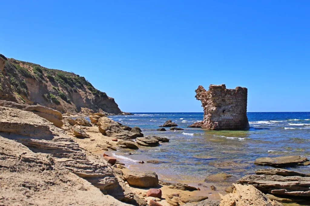
One accompanying image shows the remains of Porto Paglia’s tower beside the rocky coastline. Here the ruin identifies another human landmark, distinct from the tuna workers’ housing. The picture also shows the close relationship between water and rock, but it is not a route recommendation. Wet surfaces, waves and possible access restrictions mean that a photograph alone cannot establish whether a particular approach is currently practical or safe to follow.

Choose an access with current information
The regional description gives an approach using the SS126 and SP108 roads before the turn towards Porto Paglia, and mentions steps leading down from the parking area. Anyone with mobility requirements should therefore check the entire access route before choosing this entrance. Parking arrangements and beach facilities also need a seasonal check. Knowing where the beach is located is different from knowing which services will be operating on the day you arrive.
This coastline is exposed to wind and currents. A sandy seabed and attractive water colours are not sufficient reasons to judge swimming conditions; local notices and the actual sea state take precedence. For a visit focused on the landscape, notice instead how the buildings occupy the higher coastal edge and how the sand continues beyond them. Porto Paglia then becomes a specific example of the relationship between sea and work, with the former settlement providing context rather than merely a picturesque beach backdrop.