
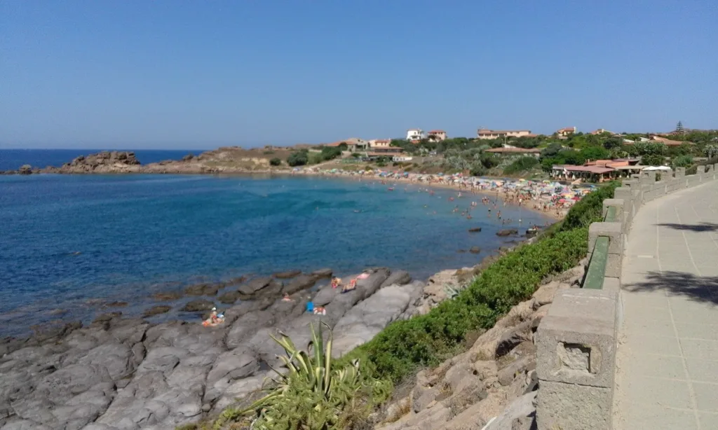

Portopaglietto is a beach best understood by first looking down from the coastal path. Sand occupies the inner part of the bay, while rocky surfaces and small headlands emerge along its sides. A single view therefore reveals different settings that are close together without being interchangeable. Someone wanting to sit on the beach and someone interested in viewing the landscape from the promenade can choose different positions around the same inlet, in the northern part of Portoscuso.
The Portopaglietto beach directory entry identifies the correct point. The name also appears as Porto Paglietto and Portupaleddu; it does not refer to Porto Paglia, in the municipality of Gonnesa. Check the town before setting a destination, especially when a search engine suggests similar names. The municipal and regional pages linked below provide two references for recognising this particular bay rather than accidentally planning a journey to another stretch of the southwestern Sardinian coast.
Sand in the centre and rock along the edges
The panoramic photograph shows the curve of the sandy shore tucked into the inner bay. Rocks dominate the foreground, changing the way the water can be approached. That distinction is useful when planning a stop: the sandy section is the place to look for when spreading a towel, whereas a view from the rocky edge principally describes the landscape. An attractive photograph is not enough to establish that the position from which it was taken offers easy access to the sea.

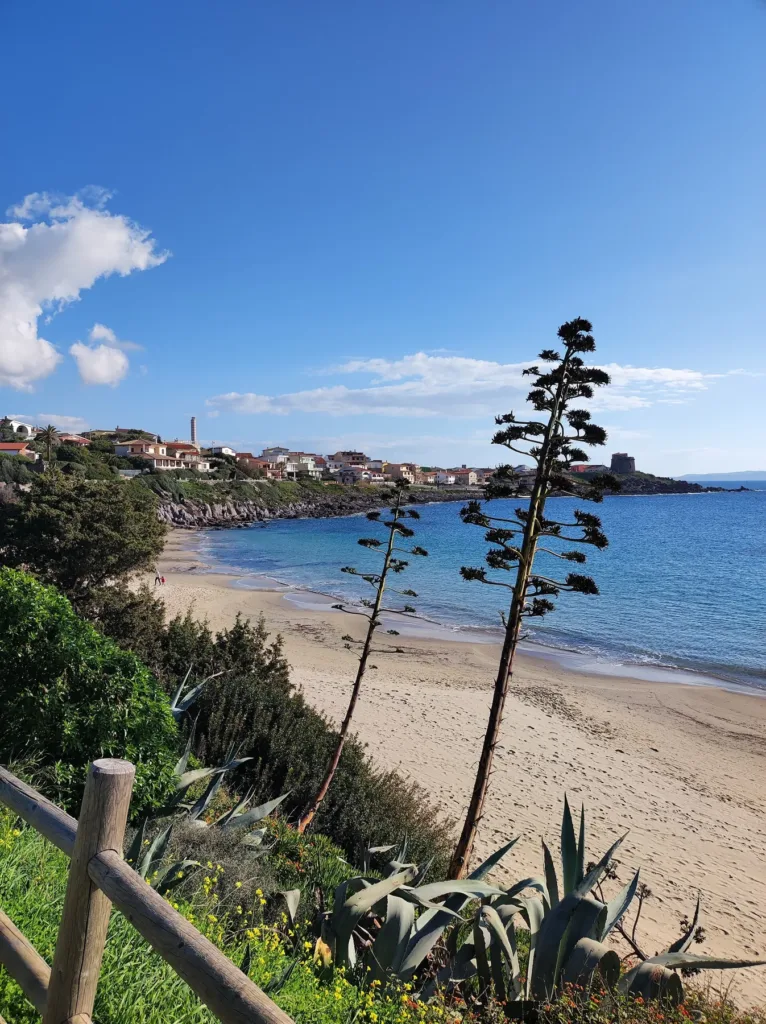
SardegnaTurismo describes golden-toned sand, a shallow sandy seabed and lateral trachyte cliffs. These are general characteristics of the bay, not a depth measurement applicable everywhere. The closer beach photograph helps distinguish the waterline from the rocky margins, but actual depth and conditions need to be assessed on the day. The enclosed shape of the coast provides useful orientation; it does not replace looking at the waves, wind and signs encountered when arriving beside the water.
A path for enjoying the view without staying on the sand
The side view shows a walkway above the coast, separated from the rocks by a low built boundary. For someone simply wanting a walk, this relationship between path and bay is as interesting as the beach itself. Moving along the permitted route changes the overlapping features: foreground rocks, the sandy curve and buildings further away. Pausing at two different positions can reveal more about the inlet's arrangement than taking only one close photograph of the water.
The regional tourism source also identifies a pine grove near the bay. It can provide a reference when looking for a shaded pause, while the spaces actually available should be checked locally. Shade on the promenade, shade among the trees and time spent on the beach are different situations worth considering when deciding where to stop. The photographs collected here show coastal views taken on different dates; they do not document the current availability of equipment, refreshment facilities or seasonal services.
How the light changes the landscape
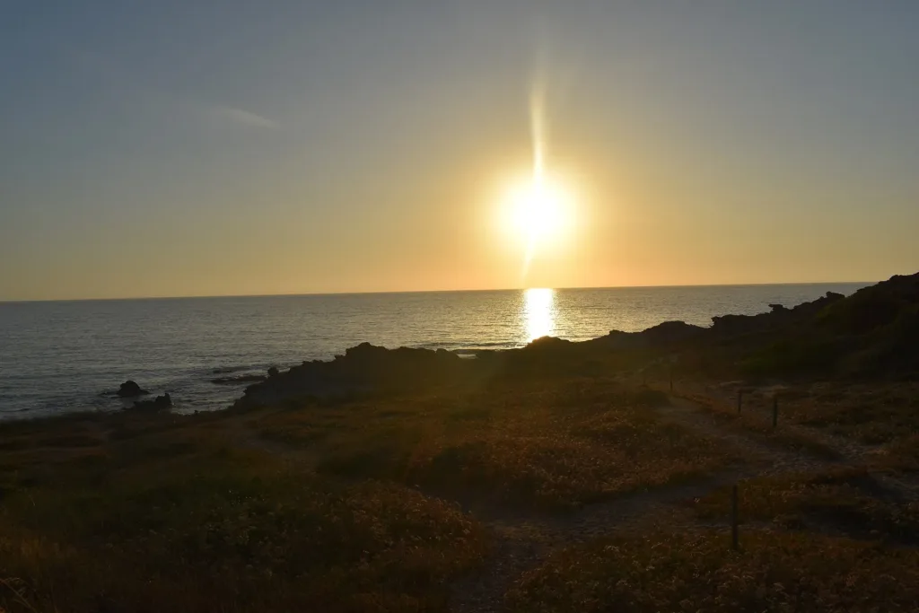
The sunset photograph shifts attention from the beach towards the sea's horizon and the dark outline of the coast. Compared with the daytime images, both colour and detail change dramatically: rocky surfaces become almost silhouettes while light is concentrated on the water. This provides a reason to distinguish two possible experiences of the same place, a beach stop and an evening observation of the landscape. Neither requires reducing Portopaglietto to the colour of its water around the middle of the day.
When photographing the bay, decide which feature you want to convey. A broad view from the promenade relates the beach to the rocks; a position near the sand makes the waterline and edge vegetation clearer; backlighting emphasises the horizon and outlines. These suggestions come from the published images, not from an itinerary requiring access to the rocks. The most suitable position remains one reachable along the permitted route, without crossing barriers or approaching exposed edges to reproduce a particular composition.

Planning a stop with current information
The municipality maintains a Mare On Line page directing readers towards information and notices about the sea. Read it with attention to dates: a document concerning a previous season does not automatically describe the present one. The same approach applies to parking, equipment hire and assistance. This guide does not certify today's bathing-water status, and a photograph of calm water should not be converted into a forecast for the conditions during your visit.
A stop at Portopaglietto can therefore be organised around three straightforward choices: reaching the sandy section, viewing the bay from the promenade or returning for evening light. To continue exploring the town, consult the separate article on Portoscuso's Spanish tower, while allowing the coastal landscape to remain this guide's main subject. The close relationship between sand, rock and the settlement is what makes this inlet recognisable beyond the circumstances of any single day spent beside the sea.