
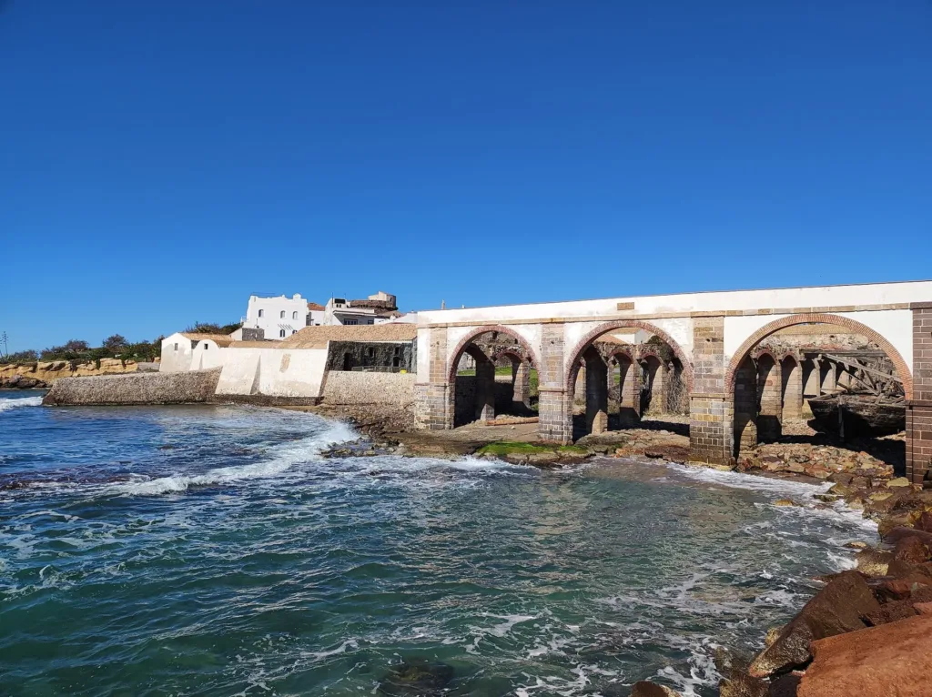

Su Pranu offers a way of looking at Portoscuso through the history of work. The name of the tuna fishery refers to more than a fishing location: it encompasses buildings designed for people, equipment, supplies and boats. Their relationship with the water is immediate, but the connection with the square matters too. The complex's two outward faces express different functions. Following that transition helps explain why this place played a role in the development of the surrounding settlement.
The correct geographical reference is the Antica Tonnara Su Pranu directory entry, distinct from commercial businesses that may use the same name. This article examines the fishery's buildings on land. It does not describe a present-day tuna catch or provide a fishing calendar. Historic structures, productive activities and current visiting arrangements are different subjects. They should not be treated as interchangeable simply because the Italian word tonnara can appear in descriptions of all three.
A sheltered inlet with a working purpose
The municipality's page about Su Pranu places the complex beside a south-facing inlet sheltered from northwesterly winds. This geographical condition helps explain the arrangement. Moving boats and materials required a favourable connection between land and water. The shoreline was therefore more than an attractive setting in front of the buildings. It was the working boundary across which the activities giving the establishment its purpose took place, and it made the surrounding service spaces meaningful as parts of a larger operation.

The Ministry of Culture's Idese entry dates the complex's origins to the late sixteenth century while describing its seventeenth-century architectural character. Those references need not compete for a single correct date: the beginning of an establishment and the development of its buildings may belong to different phases. The municipal historical account also records damage and alterations. Su Pranu is consequently better understood as a changing group of structures than as a design preserved untouched from its first day of operation.
From the gateway to the surrounding rooms
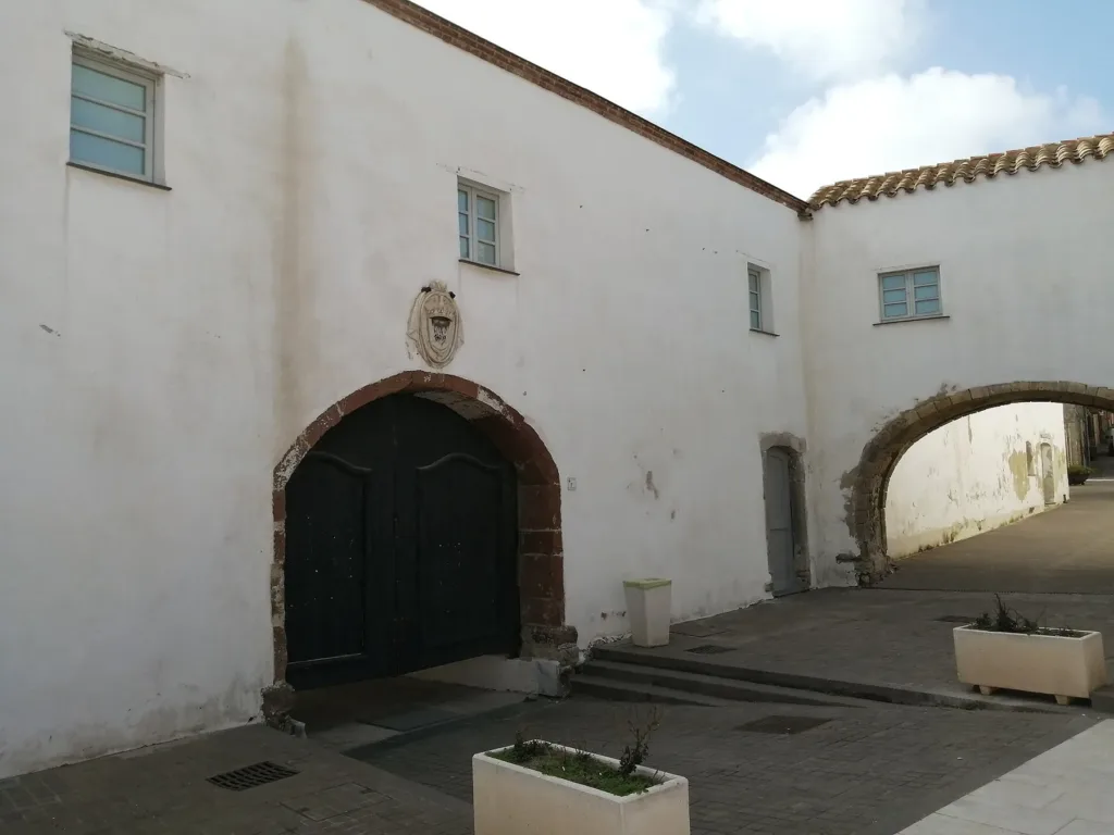
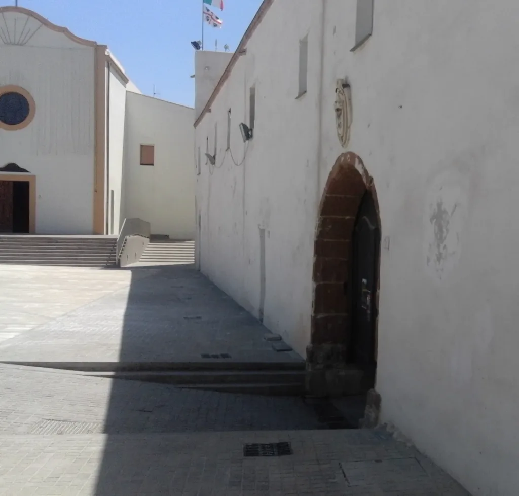
In the photograph taken from the square, the large dark door stands out against a pale wall and is framed by reddish stone. A coat of arms appears above it, while an adjacent arch spans a passage between buildings. These features distinguish entry into the complex from movement around its exterior. Looking at thresholds, openings and connections provides a practical way to investigate the arrangement without assigning an unsupported purpose to every doorway visible in the photograph.
Idese identifies the owner's residence, fishermen's accommodation, stores, a church and a boat shelter around a courtyard open towards the sea. This variety explains why searching for a single representative building is limiting. Work required places for storage and repairs, but also for living and organising collective activity. The square-facing and seaward elevations reveal two aspects of that arrangement: one concerns the relationship with the town, while the other directly addresses operations involving the water and boats.
Hierarchy and maintenance behind the catch
The municipality's historical account distinguishes the owner's rooms from those of the rais, his deputy and the crew. It also mentions workshops, food supplies and equipment for ropes. That short inventory shifts attention away from the moment of catching fish towards the system that made it possible. A fishery had to coordinate different skills, prepare materials, keep equipment functional, feed workers and allocate responsibilities. Differences between living quarters expressed a social hierarchy as well as responding to practical building requirements.
The photograph from the water's edge shows large arches facing the sea and a sequence of supports within. Their scale differs markedly from the gateway on the square. Comparing them makes the distinction between an entrance for people and goods and a space associated with boats readily understandable. There is no need to invent a working scene never witnessed: proportions, repeated supports and proximity to the water make the boat shelter's purpose legible through the surviving architecture itself.

Public heritage and its coastal setting
The ministerial source records municipal acquisition in 2006 and interventions affecting parts of the complex. Becoming public heritage introduces another phase, in which conservation and new uses encounter structures inherited from a working establishment. It does not mean that every room is always accessible or that these photographs prove today's condition. Check current municipal announcements and the organisers named in them for openings, events and available routes before arranging an interior visit around a particular space.
A brief reference to the Spanish tower, explored in its own guide, connects the fishery with the surrounding landscape. Here, however, the useful concluding comparison remains between Su Pranu's two fronts: the gateway towards the settlement and the arches towards the sea. They visibly express a place where production and everyday life belonged together. Recognising that relationship reveals more than a photogenic coastal monument and gives the different parts of the complex a shared purpose.