
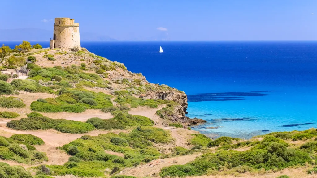

Torre Canai tells a story about two different forms of control along the coast: the observation carried out by a military outpost and, much later, control over access to a monument. Its history does not end with raids arriving by sea. It includes private use, building alterations and a recovery that returned the structure to collective enjoyment. That sequence makes it interesting even for visitors who have already encountered several other coastal towers during a journey through Sardinia.
The Torre Canai directory entry locates the monument on the Turri promontory in the southern part of Sant'Antioco island. Sources also use the spelling Cannai, while historical records preserve further variants. These names do not necessarily indicate different towers. Its position on the headland of Su Moru and its relationship with the Gulf of Palmas identify the same building despite the variations in terminology encountered when reading about its history.
A tower from the Savoy period
Italia Nostra dates construction to 1757 and attributes the design to the military engineer Vallin. The date matters: this building belongs to Savoy rule, although it joined a coastal defence system developed during earlier periods. Describing every Sardinian tower indiscriminately as Spanish would erase that distinction. Canai answered the need to observe an exposed stretch of sea, where recognising a suspicious presence early could allow an alarm to reach those responsible for organising a response on the island.

The university's ASMSA resource also describes practical connections between the outpost and the community through records concerning supplies. A tower depended on more than an advantageous viewpoint: it required people, materials and provisions. That aspect directs attention away from an isolated silhouette towards the network supporting it. The position offered a visual advantage, but it did not make the garrison independent of the resources, decisions and assistance provided by the island's inhabitants.
A compact structure above irregular ground
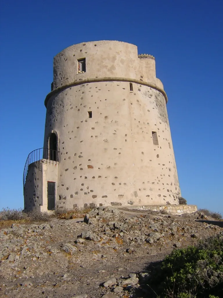
The photographs show a body narrowing upwards beneath a more vertical upper section. The close view makes openings and entrances easier to follow, while the wider photograph explains the relationship with the rocky headland. These observations complement one another. From a distance, the monument's role as a landscape reference becomes apparent; closer up, its constructed surface can be distinguished from the uneven ground. The sea behind the tower immediately indicates the principal direction towards which its outlook was oriented.
The managing association's description includes a circular room and an internal connection to the gun platform above. These elements help explain the vertical arrangement without imagining a castle made up of many separate wings. A modest footprint concentrates functions and movement within a compact volume. However, the surviving appearance should not be treated as an unchanged picture of the eighteenth century. Alterations between construction and the present affected the upper spaces and service areas in particular.
Private residence and recovery for the community
The FAI entry recalls conversion into a holiday residence during the 1960s. The change in function brought substantial alterations and restricted collective use of the place. This is essential to understanding the later recovery: the task was more than making a ruin presentable. It involved addressing interventions introduced for domestic purposes and reconsidering the connection between a historic building, its surroundings and the community that had long recognised it as a reference within the coastal landscape.
The university account identifies 1988 as the start of restoration directed by Luciano Rossetti and 1994 as the year of public reopening. Italia Nostra documents the recovery of previously altered features, including the cistern and sentry box. Returning the tower to public use did not mean erasing every trace of time, since some changes could not be completely reversed. It is therefore helpful to see a restored monument with its own conservation history, rather than an object surviving untouched from construction.

A place for cultural observation too
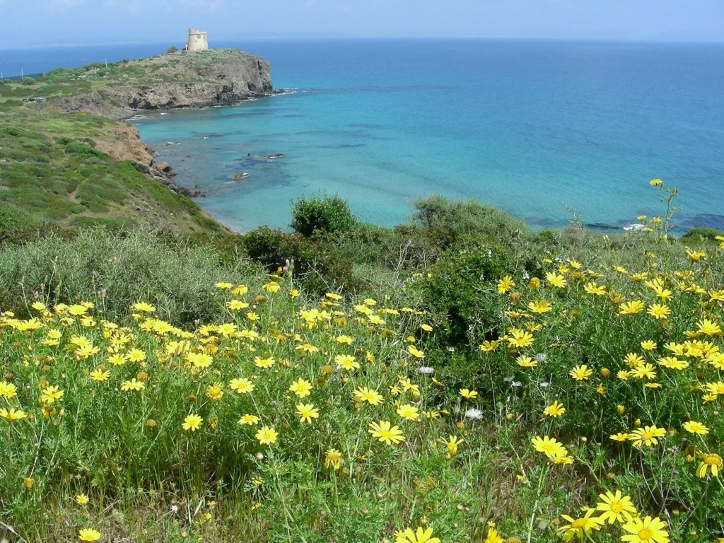
Italia Nostra's documentation presents displays concerning both the tower and the island's natural environment. That approach connects the building to the territory visible from its promontory. The photograph with flowering vegetation in the foreground suggests the same relationship: the masonry is only one component of the landscape. Colours and plant cover vary by season. The image does not promise identical flowers during every month, but records one combination of the monument and its surrounding environment.
For interior access, consult the current Visit Sant'Antioco page, which provides contact and booking information. Public recovery does not mean continuous opening. A useful thread for the visit is straightforward: recognise the eighteenth-century outpost, identify changes in use and understand the work required to make it shared again. Seen in this way, the panorama accompanies a specific history, that of a tower returned to a place within community life.