
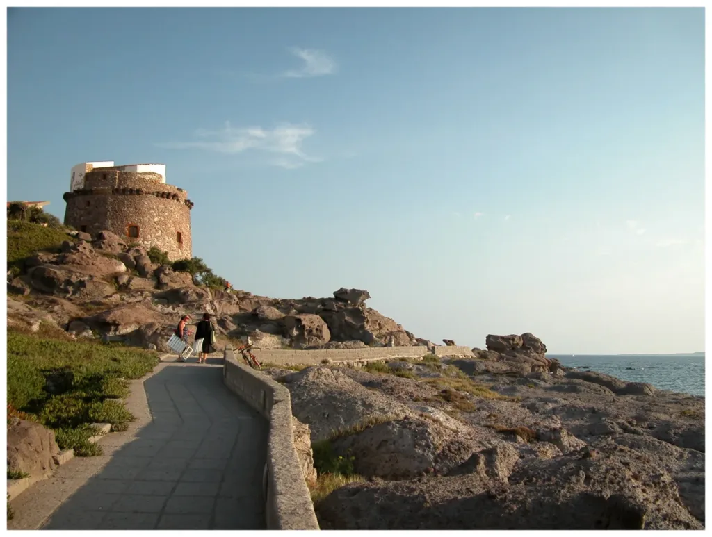

Portoscuso's Spanish Tower rises from the rocky edge of the settlement as a compact structure, wider at its base and progressively narrower towards the top. Seen from the sea or the coastal approach, its relationship with its setting is immediately apparent. The position was not accidental. The tower had to watch approaching vessels and help protect a place where navigation and economic activity depended on the security of the surrounding coast and its maritime connections.
The tower is on Via Torre, near the Ghinghetta cove. For geographical ordering, this article is linked to the Portoscuso municipality directory entry as a nearby town-centre reference. That point identifies the town hall, not the entrance to the fortification. Keeping these distinct avoids presenting a directory reference as an exact monument location. To reach the tower itself, follow the signs and information specifically identifying Via Torre and the historic site.
A defensive post connected with the port's livelihood
The municipality describes the tower as a symbol of Portoscuso's beginnings and places it within the period of Spanish government. Its tasks included maintaining an armed presence, spotting hostile vessels and protecting maritime traffic. Tuna fishing and coral fishing help explain the economic importance of defence. Their connection is mentioned here to clarify why a protective post was needed, rather than to turn this article into a history of the tuna works or fishing techniques.
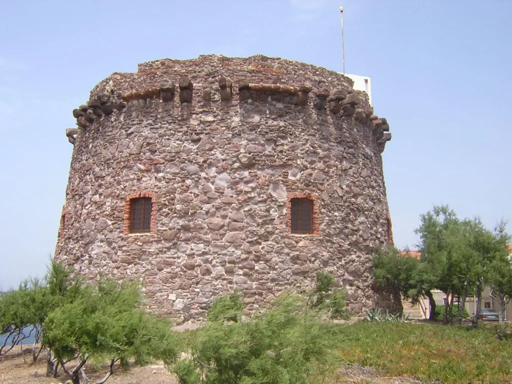

The Ministry of Culture's Idese record dates the tower to the sixteenth century. The municipal historical account also recalls attacks, repairs and later rebuilding. It is therefore sensible to distinguish the origin of the defensive post from the form that survives. An initial construction date does not establish that every visible part has remained unchanged. The tower has a building history as well as a military purpose, and its present surfaces should be considered with that history in mind.
Changing distance changes what the form reveals
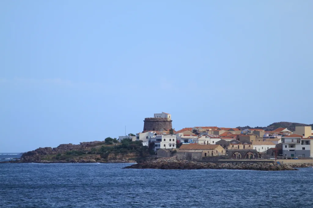
The close view shows the truncated-cone profile, stonework and openings distributed across the wall. Projecting elements interrupt the upper edge. From farther away, those details become less visible, while the isolated mass above the coastline remains prominent. The photographs therefore offer complementary readings. One concerns the materials and articulation of the structure; the other concerns how the defensive post occupies its headland and becomes a recognisable feature within the coastal landscape and the outline of the town.
The elevated entrance recorded by the ministry distinguishes the tower from an ordinary building with a doorway directly at ground level. Separating ground and entrance forms part of its defensive logic. Descriptive sources do not agree on every measurement or on the precise counts of steps and openings, so no numerical survey is offered here. The important characteristic is control of the threshold, considered alongside the substantial masonry protecting the room within the structure.
Observation and armed response were different tasks
According to Idese, the tower's dimensions and form indicate a heavy-defence role in addition to surveillance. Equipment included artillery and weapons for the garrison. Spotting a vessel and possessing the means to oppose it were not the same activity: the tower combined observation with the capacity to intervene. Recognising that distinction takes us beyond the image of a simple lookout and helps explain the significance of the terrace and the spaces used by its defenders.
The position allowed visual relationships with other coastal points, including the towers of Calasetta and Carloforte mentioned in the ministry's record. The post therefore belonged to an observation landscape extending beyond the settlement alone. The municipal account also describes a rainwater-fed cistern, recalling the garrison's everyday needs. Defence required supplies and sustained occupation as well as strong walls and a broad view. These practical requirements connect the monument's military purpose with the ordinary work of maintaining a presence there.

The monument today: exterior views and interior access
Idese records exterior visibility and limitations on mobility access. A nearby route should not therefore be taken as proof that the interior or terrace is always open or easy to reach. For visits and events, check municipal announcements. A photograph cannot certify conditions on the day of a planned visit, and appreciating the site's historical importance does not depend on being able to move independently through every part of the structure without guidance.
An exterior reading can begin with the relationship to the rock, continue along the masonry surfaces and finish by considering the tower within the town's coastal outline. The wider photographs show how a defensive structure has become part of Portoscuso's visual identity. Understanding its original role adds depth to that familiar silhouette. Behind it lie work, traffic, threats and the organisation of defence, brought together in a relatively compact building that rewards more than a passing glance.