
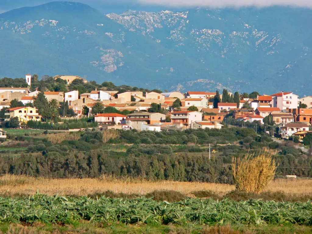

Seen from the Porto Botte area, Villarios appears as a cluster of houses above cultivated fields. Roofs extend along a modest rise, with larger hills further behind. The view seems quiet, yet the position of the settlement reflects a necessary decision linked to abandoning an earlier village. Understanding this hamlet of Giba means holding two places in mind: the one where the community lives today and the former site from which it moved. The landscape contains a history of relocation.
The introduction to Giba’s historical municipal inventory, published by the archival authority, places the rebuilt settlement on Su Estrai hill. It attributes the move to underground water infiltration from the Monte Pranu reservoir, which affected the old centre. This should not be simplified into a story of a village merely submerged beneath a lake. The document concerns groundwater and the condition of the settlement. That distinction explains why the historical site and the present village occupy separate positions in the landscape.
A name carried to another place
The name Villarios remained attached to the community while its buildings changed. This matters when comparing maps, recollections and photographs. A view of the new village does not automatically illustrate a square mentioned in an older document. Equally, a reference to the former settlement may concern somewhere no longer inhabited. Before matching an image to a family memory, establish which of the two places it represents. Continuity of a name can otherwise conceal a substantial change in physical location.
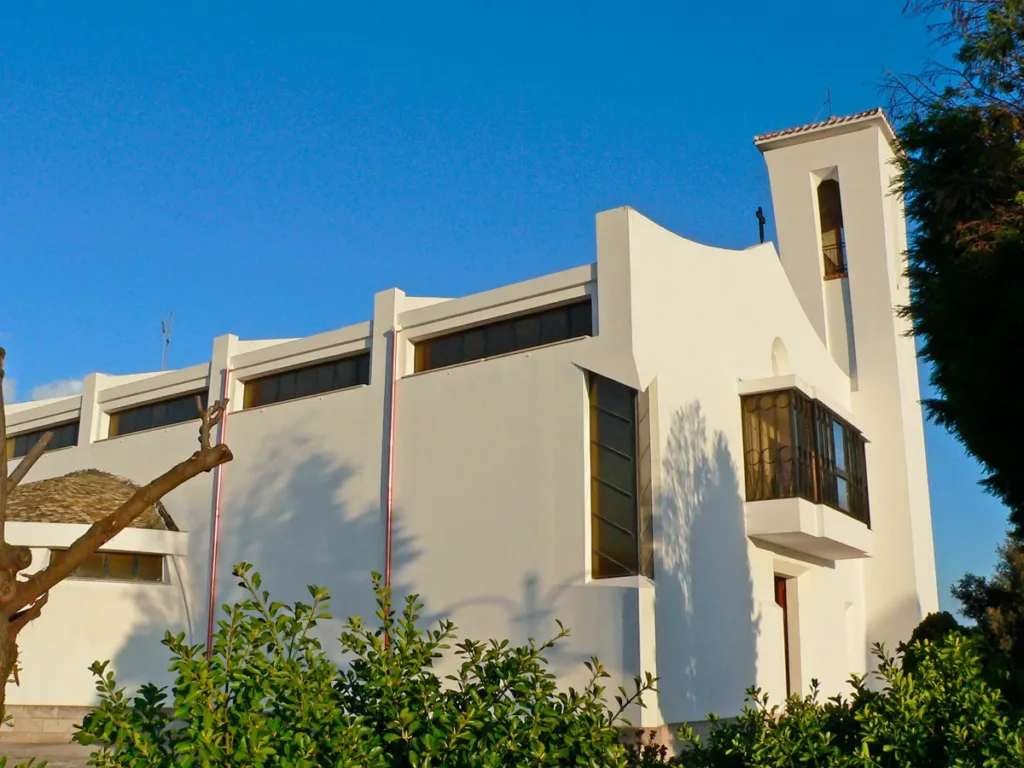

The photograph of San Giuseppe church records the new settlement. Pale walls, horizontal openings and a simply outlined bell tower belong to a modern architectural vocabulary, different from the expectations created by the phrase medieval village. This is not Santa Marta church. Distinguishing the dedications prevents an older monument from being mistakenly placed within the rebuilt centre. It also allows recent buildings to take their proper place in local history, rather than being overlooked because they do not look ancient.
The former site and the present centre
To locate a surviving reference within the historical area, use the Santa Marta directory page. The geographical point associated with this article refers to that landmark of the older territory, rather than the centre of present-day Villarios. Santa Marta serves here as an orientation point; its architecture deserves a separate investigation. The relocation story concerns the relationship between the two sites, without requiring every monument encountered to become another subject developed within the same article.
The municipal inventory also recalls Villarios as the original administrative centre of the municipality established in 1853. Moving an administrative headquarters and moving people’s homes are nevertheless different events. A community can lose a municipal function while remaining physically in place, then relocate at another stage. Keeping these processes distinct prevents the sources from being read as though one event simultaneously changed the settlement’s name, its local government and every house. Institutional history and the history of buildings need separate attention.
What the hill reveals
In the overall view, houses form a recognisable band above cultivated ground. Mostly low buildings allow a few vertical features to stand out, while vegetation follows the edges of plots. The photograph makes these relationships visible but cannot, by itself, reconstruct the planning scheme or establish the order in which individual buildings appeared. Its immediate evidence concerns relative position. The village overlooks the plain and remains clearly separated from the fields nearest the camera, rather than merging into an uninterrupted built-up surface.
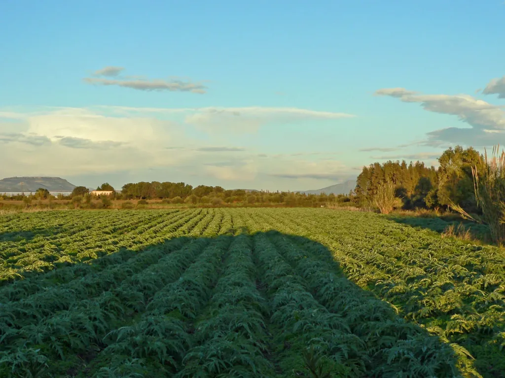
The third image brings those fields closer, showing rows of artichokes in the Villarios area. Lines of cultivation lead the eye towards trees and distant buildings. This is not a record of the moment of relocation, nor a measure of current agricultural output. It documents farmland in 2009. Beside the broader village view, it helps explain a tangible relationship between settlement and cultivated land. Villarios consequently appears as an inhabited working territory, rather than simply a convenient viewpoint over the surrounding country.

Consulting records before seeking traces
The Giba archival inventory offers a starting point for further reading. An inventory directs research towards administrative evidence and supplies historical context, but it does not replace checking present access conditions. Seek current local information before planning a route through the former village area. Appearing on a historical map does not establish that a site can be crossed freely or that it is open to the public under today’s arrangements.
Villarios suggests a kind of continuity that does not depend on every house surviving. A name, relationships between people and attachment to the surrounding land can persist through rebuilding. Looking at the hilltop settlement, its modern church and the fields below changes the question from simply what is old to how village life continued. That perspective makes present-day Villarios understandable without erasing its predecessor. The two places belong within one community’s history, even though their buildings cannot be treated as interchangeable evidence.