
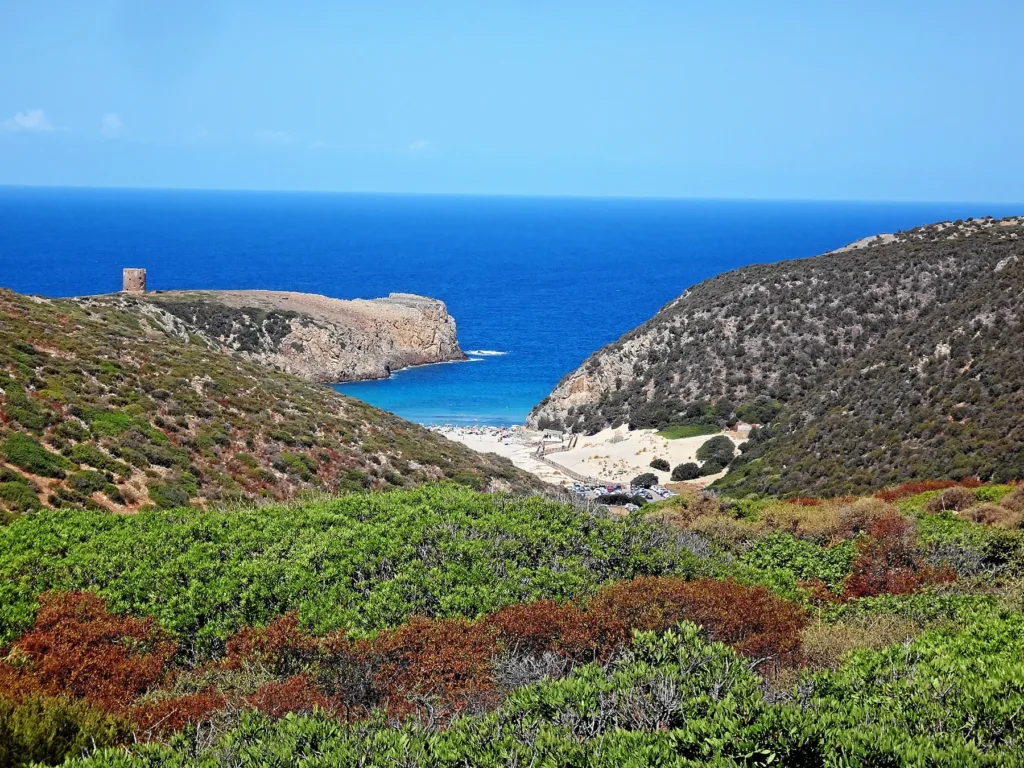

Cala Domestica is recognisable before you reach the water. Its beach occupies the inner end of a narrow inlet between pale rock walls, while sand continues inland behind the shore. In Buggerru’s territory, close to the boundary with Iglesias, this meeting of valley, dunes and sea creates a landscape quite different from a long, open beach. Understanding it means looking sideways and inland as well as towards the horizon.
A valley meeting the sea
The Ministry of Culture describes the inlet as a ria, a valley reached by the sea, and places the main beach at the mouth of the Gutturu Cardaxius stream. That geographical term helps explain what you see. The headlands are more than attractive framing on either side of the sand: they define a space that continues into the countryside. The relationship between that inland corridor and the opening towards the sea gives the cove its particular shape.
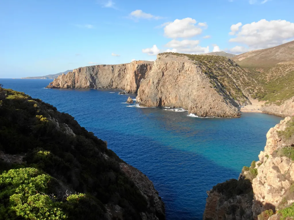
From the central part of the beach, the limestone walls provide a clear sense of scale. Photographs show how small the sandy shore appears beside the mass of the cliffs. A wide view communicates this relationship more effectively than a close-up of blue water. Including both rock and sand helps explain the depth of the inlet, without treating a photograph’s colours as a guarantee of what the water will look like in every season or light.

The dunes extend behind the shore
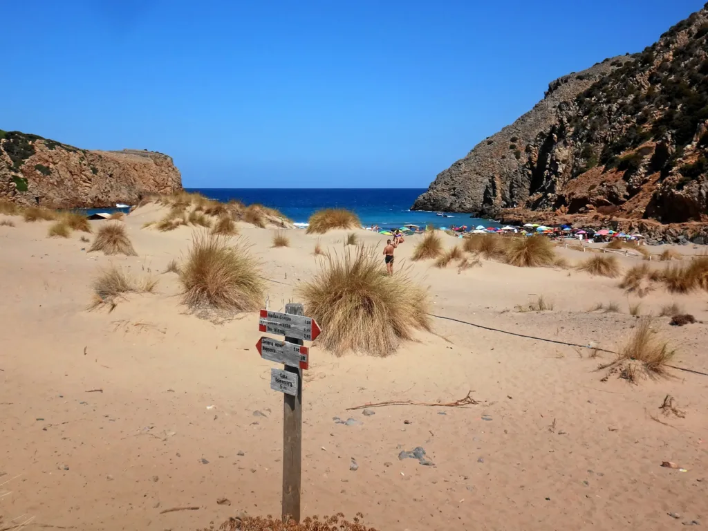
The sandy landscape does not end where visitors spread their towels. The ministerial description records dunes extending more than three hundred metres inland. The boardwalk therefore offers an opportunity to observe the transition from vegetation to more open sand. Staying on the established route avoids creating additional lines of trampling and makes it possible to appreciate the landscape without damaging the very features that give the place its character.
There is no need to climb every sandy rise to photograph the cove. From the boardwalk and permitted access points, try comparing a view towards the sea with one looking back into the valley. They explain different parts of the same setting: the first shows the cliff frame, while the second reveals the sand and vegetation frequently left outside pictures taken from the water’s edge. Leaving sand and fragments where they belong is a practical part of that approach.
Sa Caletta and the rock passage
Facing the sea from the main beach, the connection towards Sa Caletta, also called La Caletta, lies on the right. A small passage through the rock leads to a neighbouring coastal space with its own proportions. Its appearance in a destination guide does not guarantee that it is currently passable. Rough seas, maintenance and local restrictions can change access, so follow signs on site and turn back if the route is closed or affected by waves.
The comparison between the two beaches is primarily about scale. In the larger cove, your attention moves between dunes and headlands; the second beach is more compact. The photograph of Sa Caletta illustrates this difference without suggesting that it will always be empty. Seeking a quiet corner is no reason to bypass barriers, scramble around the edge of the passage or block a route that other visitors need to use on their return.
Built landmarks within the bay
A coastal tower stands on the southern headland, and evidence of former mineral shipping remains near the shore. Within this reading of the bay, they are useful visual landmarks: human structures can be distinguished from the natural outline of the coast. The transport history deserves its own discussion. For location and nearby services, the portal’s Cala Domestica listing provides a geographical starting point connected to the directory map.

Plan around actual access conditions
Buggerru’s municipal tourism portal describes the approach from the coastal road and lists parking, a camper area and beach facilities. Check availability, charges and operating periods for your intended date: a facility mentioned in a destination description is not necessarily open throughout the year. Bring water, sun protection and footwear suited to what you actually intend to do, particularly if time on the beach will be combined with walking beyond the main access.
A bay enclosed by headlands is not automatically safe for swimming. Assess local signs, wind and sea conditions rather than relying on photographs alone. Similarly, a boardwalk does not by itself describe the entire journey for someone with reduced mobility: continuity, surfaces and available assistance need checking. Allowing time to look inland as well as towards the water makes Cala Domestica more than a beach stop, while planning around real conditions keeps the visit grounded in the place itself.