

Colle Rosmarino is a green presence within Carbonia: a hill around which the built-up area changes direction and elevation. A municipal planning report gives its height as 165 metres and identifies it among the area's valuable landscape features. For visitors, its interest lies less in reaching a challenging summit than in examining the relationship between a wooded rise, surrounding homes and the places shaped by work.
The Colle Rosmarino Park directory entry locates the area on the map. The marker represents the park, rather than a certified walking route or a complete list of entrances. That distinction matters when planning a visit: choose an entrance that is actually open and read any notices there instead of assuming that a direct line towards the highest point is a suitable path.
A hill that helps shape the city
Documents for Carbonia's historic-centre plan describe the northern expansion of the city as wrapping around Rosmarino. The hill is therefore more than a distant backdrop to the buildings. It helps explain why the neighbourhoods cannot be understood simply as a flat grid. Changes in the terrain introduce bends, shifts in level and views that open or close as the observer moves.
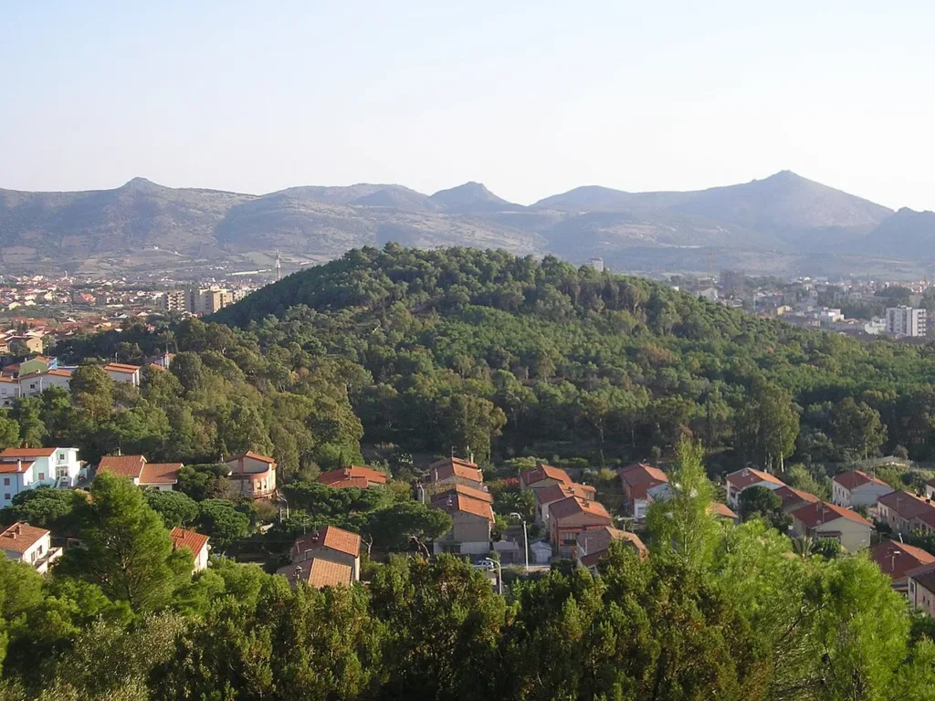

The municipal dossier on the city's development also reproduces a plan for a north-western neighbourhood at the foot of the hill, dated 17 June 1939. It offers a specific historical reference for this relationship between urban growth and topography. Visitors do not need to reconstruct every planning decision to appreciate it. A view of Rosmarino from outside shows how closely houses and trees occupy the same urban landscape.
Three scales of observation
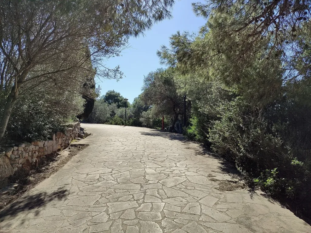
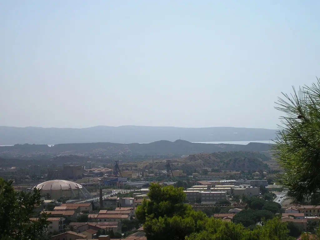
The photographs in this article offer three ways of looking at the place. The first follows a tree-lined path, bringing its surface, edges and vegetation into the foreground. The second views Rosmarino from Monte Leone and places the whole hill within the town. The third looks from Rosmarino towards Serbariu, connecting the urban green space with an industrial landscape.
These are archive photographs taken in 2007 and 2020. They help explain spatial relationships, but cannot guarantee the current appearance of every path or viewpoint. Comparing a close view with a broad one is especially revealing here. What feels like an enclosed setting along a wooded route becomes a recognisable component of Carbonia's overall form when viewed from farther away.
Read the view before identifying individual buildings
If you find an open, permitted viewpoint, begin with the largest elements: the hill beneath you, nearby neighbourhoods, industrial areas and the horizon. Only then look for individual buildings. This approach makes it easier to avoid treating a resemblance as a certain identification. Haze, vegetation and the exact position of the observer can all make familiar landmarks harder to recognise.
A view towards Serbariu does not replace visiting the complex, just as a collection of rooftops does not explain every street beneath it. For a closer examination of the civic centre, continue with the separate article on Piazza Roma. The subject here remains Rosmarino and its role in understanding the urban landscape, rather than a second itinerary through the city's monuments.

Walking through a maintained urban landscape
A hill inside a town still requires attention to gradients and surfaces. The path photograph shows a paved section, but does not establish that the entire park is suitable for wheelchairs or pushchairs. If access matters for your group, check the entrance, continuity of the route and any obstacles. The hill's maximum elevation is not the amount you will climb: that depends on where you start and which route you choose.
Maintenance is part of the life of this green space. In May 2026 the municipality published a contract award concerning works at Colle Rosmarino urban park. That record confirms an administrative action, but does not by itself tell visitors which paths are open today or whether the works have finished. Check municipal notices before setting out and follow the information displayed at entrances.
For a short visit, choose one clear purpose: examining the boundary between trees and houses, comparing the hill with a map, or finding a permitted view over the city. There is no need to reach every corner. Alternating close observation with a wider perspective makes Rosmarino easier to understand. The park provides green space to walk through, while the hill remains an essential part of Carbonia's everyday geography.