
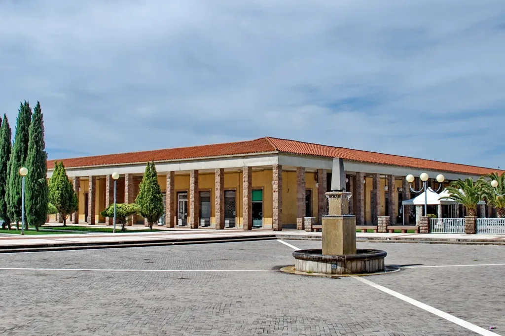

In Cortoghiana, architecture reveals itself through a rhythm: a pillar, a shadow, an opening, then another pillar. Piazza Venezia provides an immediate introduction to the design of this mining settlement, which forms part of the municipality of Carbonia. Its long colonnaded fronts invite you to consider relationships between buildings before looking for an individual monument. The square is a useful starting point for understanding how a design can shape collective life.
This walk focuses on Cortoghiana’s urban layout and public centre. The Piazza Venezia directory entry locates the square on the map and helps distinguish it from places with the same name elsewhere. Central Carbonia has its own guide to Piazza Roma. These are separate places, each offering a way into the architecture of planned towns.
A settlement designed for mining workers
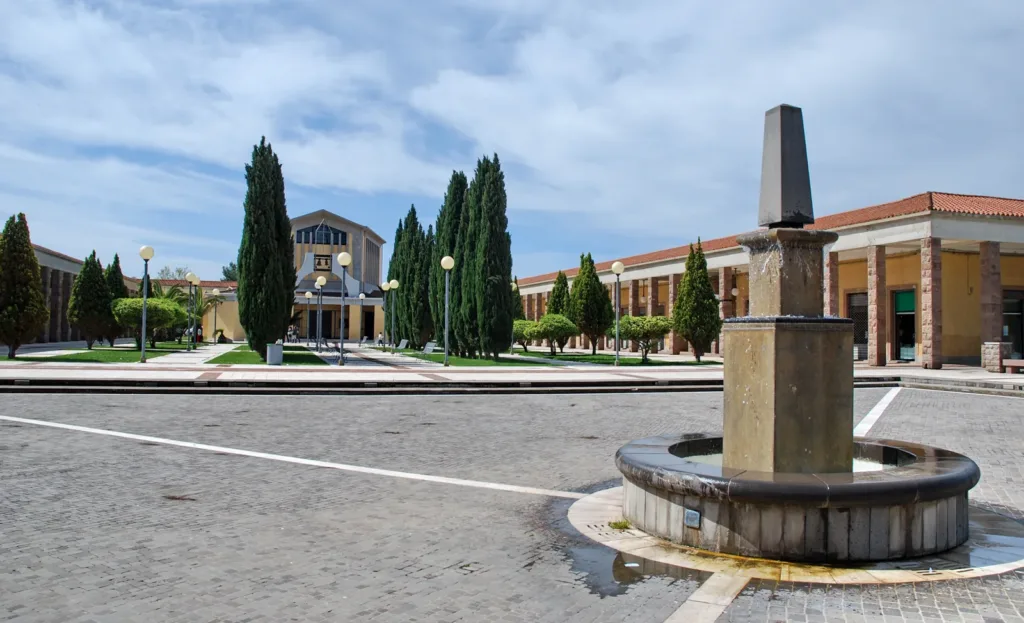
The Geomining Park records the original name Villaggio Umberto and the inauguration on 15 May 1942. That date belongs to the settlement’s public history; it does not mean that every building visible today was already complete. The Sacred Heart church appearing at the back of the square in the photographs dates instead from the post-war period, in the 1950s.

Saverio Muratori received the urban design commission. A historical panel published by the municipality describes a design extending from the street network to buildings and their details. The settlement was intended for approximately five thousand residents, but wartime difficulties limited its construction. During a visit, it helps to keep three things in view: the original proposal, what was actually built, and subsequent changes to the place.
The avenue and the street grid
The municipal documentation highlights an orthogonal layout aligned with the cardinal directions. Viale Amedeo di Savoia forms its central axis, while Piazza Venezia makes the meeting of the grid’s directions visible. A plan helps explain this order more readily than a single photograph: it also shows relationships hidden behind the buildings when you are standing at street level.
To find your bearings, identify the avenue first, then the point where the square opens out from the street. Next, look at how the depth of the space changes. A nearby frontage occupies much of your field of vision; a distant one becomes a line. This simple comparison reveals distances and alignments without turning the walk into a catalogue of buildings.
A colonnade experienced on foot
Carbonia Turismo presents Piazza Venezia as a place for social encounters and services, defined by continuous covered fronts. A colonnade brings together two experiences. Seen from outside, it belongs to the facade; walked through, it becomes a sheltered space open towards the square. Movement therefore provides a way to understand the architecture alongside the more familiar view taken from a fixed position.
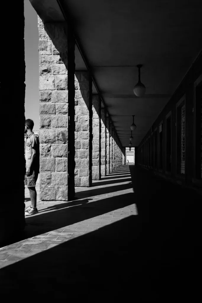
In the black-and-white photograph, light enters through the lateral openings and casts diagonal bands across the floor. The row of supports gradually narrows in perspective towards the far end. This image makes the spatial rhythm easy to recognise, although it does not describe the lighting at every season or hour. On a walk, look for the way that rhythm changes as you move a few steps.

The colour view across the square suggests another observation. Beneath the roof edge, the continuity of the openings brings different stretches of frontage together. Trees, lamps and street furniture occupy the foreground and may interrupt your perception of the whole. Comparing an oblique view with a frontal one helps separate the building’s geometry from objects placed within the public space.
Homes and public space at different scales
The Cortoghiana planning dossier distinguishes low buildings intended for commercial premises from three-storey housing with shops and colonnades at square level. It also identifies pink trachyte in the pillars. Repeating a shared element does not require every building to have the same height or function. The centre’s coherence emerges in part from the relationship between different kinds of buildings.
When looking at a support, consider its cross-section and its relationship with the adjacent opening. Then step back and locate that same element along the frontage: a detail begins to explain the larger space. To photograph this relationship, a pair of pictures can be more useful than several similar views. Take one close enough to show the pillar and another wide enough to include the building’s corner.
Comparing the proposal with the built place
The municipal dossier reproduces and discusses models of the design. The proposed square extended further and included elements that were never built. Images of the proposal therefore explain the architect’s intentions; they should not be treated as an exact map of the buildings standing today. In photographs of the actual place, look instead for the spaces that took shape and the relationships still visible between them.
Finish by returning to a position where the square opens into a broad view. After walking through part of a colonnade, the whole becomes easier to understand: what first appeared simply to be a long facade reveals a sequence of thresholds, routes and outlooks. Cortoghiana remains a lived-in settlement. Observe homes from the street and keep entrances and commercial passageways clear. Its public architecture is understood partly through its relationship with those everyday uses.