
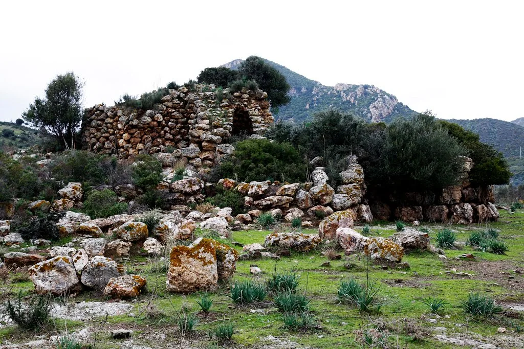

Sa Domu ’e S’Orku in Domusnovas becomes easier to understand when three components are separated: the central tower, the bastion surrounding it and the outer enclosure with further towers. Its surviving outline may look like a compact mass of stone, yet it belongs to an intricate structure developed through several phases. The monument stands west of the town, between limestone uplands and the Cixerri valley. Always include Domusnovas when locating it, because other Sardinian monuments share similar names.
A popular name and a complex building
The name is translated as the ogre’s house and occurs at other ancient sites in Sardinia. It reflects the way an imposing and unfamiliar building was interpreted in popular tradition, rather than identifying its actual builders. This is a monument of Nuragic civilisation. The national heritage catalogue classifies it as a tholos nuraghe and assigns it to the fourteenth–tenth centuries BC, while other accounts use broader periods to describe the development of the complex.
The operator describes construction in stages between 1500 and 900 BC; SardegnaCultura gives a range of 1600–1000 BC. These summaries should not be compressed into an invented foundation date. What matters when visiting is the recognition that the building need not have begun in its final form. Masonry can retain evidence of enlargement, while the loss of upper sections makes the original relationships between different parts harder to understand at first glance.

Beginning with the central tower
The regional archaeological description identifies a southern entrance with a lintel and a passage leading to the internal chamber. The tower is circular on the outside, but its interior does not simply reproduce that circle: the chamber is elliptical. This difference helps explain the thickness and organisation of the masonry. A Nuragic tower is not a thin shell around an empty space; passages, niches and stairs are incorporated into a substantial body of stone.
Recorded details include two niches and the opening of a staircase affected by fallen material. The stair indicates vertical circulation in the ancient building; it is not an invitation to look for a usable route today. The surviving tower height, given as roughly four and a half metres, is not its original height. Any attempt to imagine the missing volume should distinguish the remains that can be observed from explicitly labelled reconstructions of the lost upper levels.
The bastion and the outer enclosure
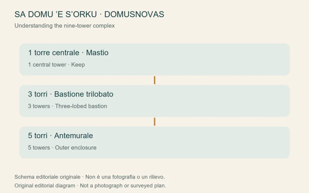
A three-lobed bastion develops around the principal tower. The term refers to three additional towers connected by masonry and related to an internal space. Farther out stands the enclosure with five towers. This arrangement explains descriptions of a nine-tower nuraghe: one central tower, three belonging to the bastion and five on the outer circuit. It does not mean that nine isolated and fully preserved structures can simply be counted during a walk around the ruins.
The original diagram in this article is intended to clarify that hierarchy. It is a conceptual graphic, not an archaeological plan, and establishes neither distances nor compass directions nor authorised visitor routes. At the monument, looking for relationships between the core, courtyard and outer defences is more helpful than expecting the ruins to match a simplified drawing. The operator also publishes representations of the complex; note carefully which are surveys and which are artistic reconstructions.
Reading masonry without inventing a story
The operator highlights local limestone and contrasts the less regular courses of the central structure with the more orderly arrangement of the outer enclosure. Such observations support a reading of successive building stages. They do not establish an exact year for each stone. Comparing the size of blocks, the direction of courses and the junctions between walls provides a concrete way to examine the building without assigning unsupported functions to every feature.
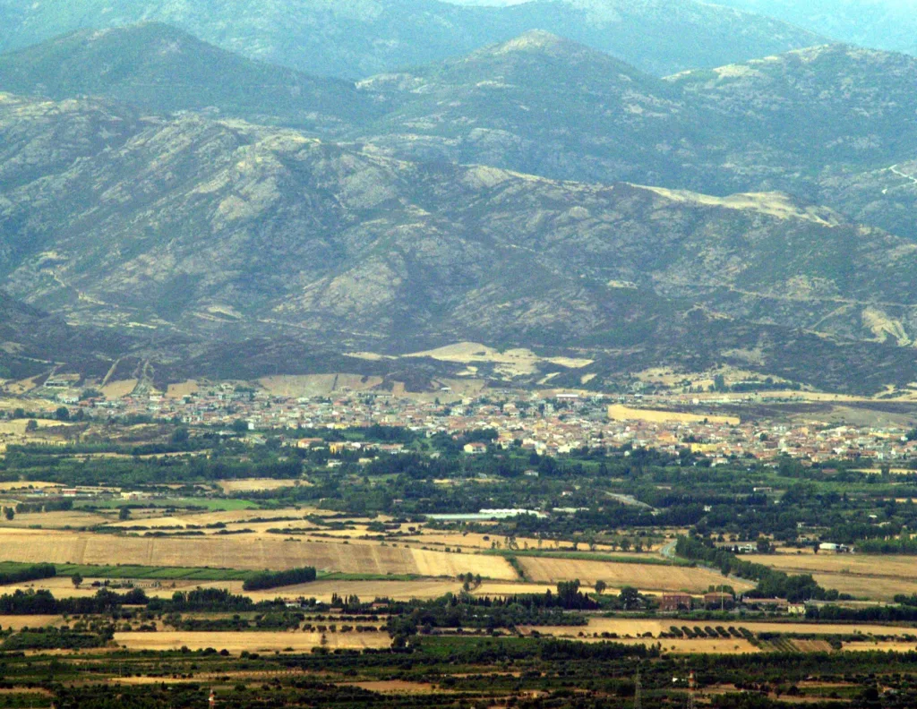
Settlement structures and traces of later occupation are also reported outside the principal complex. The nuraghe should therefore be understood as part of an inhabited setting rather than simply a tower overlooking the landscape. Its position between uplands and plain helps place the structure within that territory. The photograph of modern Domusnovas included here supplies geographical context; it does not claim to reconstruct the appearance of the surrounding area during the Bronze Age.
Arranging access from Domusnovas
The Sa Domu ’e S’Orku directory entry identifies the correct location. Consult the Consorzio Natura Viva Sardegna website, which gives the address as Via Nuraghe, for current visiting arrangements and bookings. Older descriptions of an unmanaged site cannot establish present access conditions. A guided visit can be particularly valuable for explaining the overlapping evidence: separate construction phases, collapsed parts and connections between rooms that are not obvious from the surviving outline alone.