
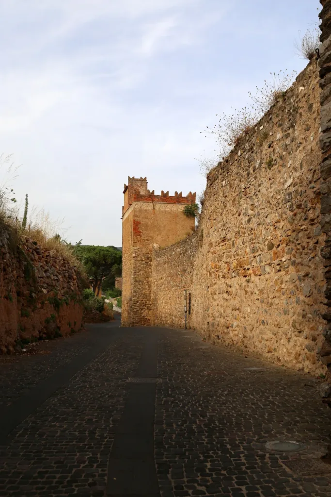

The medieval walls of Iglesias remain a physical presence within the modern town: stretches of stone, towers and openings that recall fortified Villa di Chiesa. To appreciate them, try changing the question you bring to your walk. Rather than searching only for a scenic viewpoint, ask where the boundary between the inhabited town and the surrounding territory once lay, and how people crossed it.
The enclosure has not survived as an unchanged object. Demolition, restoration and urban growth have altered what can be seen. Walking beside the remains therefore means distinguishing the historic circuit from the sections recognisable today. That difference is not a weakness of the visit. It is one of the clearest ways in which the town's changing history becomes visible.
The boundary of Villa di Chiesa
SardegnaCultura connects the fortifications with the medieval town's Pisan history and describes later periods of conflict and rebuilding. Four principal gates are named: Maestra, Castello, Sant'Antonio and Nuova. Their presence helps explain that a defensive enclosure did more than separate inside from outside. It also organised crossing points towards roads beyond the town.

When looking at a historical map, consider the openings before tracing the wall between them. This places access at the centre of your reading, rather than treating the circuit as a distant scenic line. A gate identifies a crossing, while the curtain wall establishes a continuous boundary. However, not every opening visible today should automatically be identified as one of the medieval gates.
Why sources give different tower counts
This is a useful case for avoiding false precision. SardegnaCultura, referring to documents from 1308, describes twenty towers, while Iglesias Turismo gives a figure of twenty-three. Both numbers appear in institutional sources. They should neither be combined into a single unquestioned total nor treated as a count of towers accessible to visitors today.
For your walk, the practical consequence is straightforward: pay attention to the position and function of surviving structures rather than trying to make a total add up. A detailed historical reconstruction requires comparison of dates, counting criteria and specialist documentation. The municipal booklet Le fortificazioni medievali provides further study. Read it as historical interpretation, not as a current timetable of visitor access.
A tower and a curtain wall serve different purposes
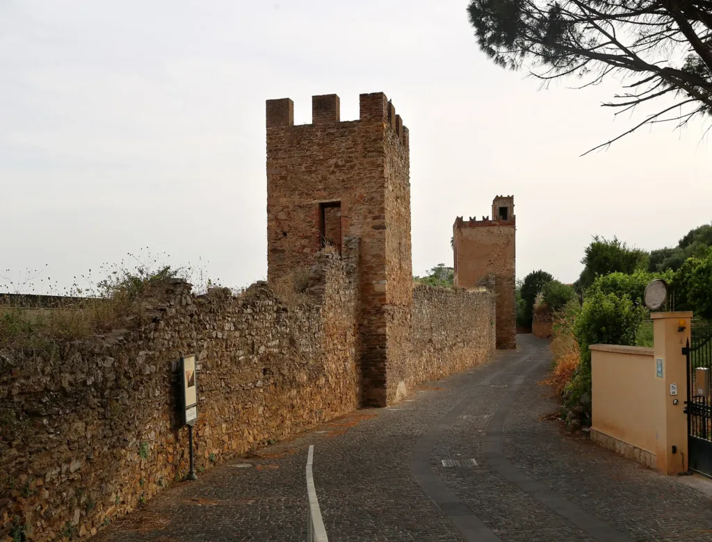
At a surviving section, identify the continuous wall and the volume projecting from it. Your first impression may be of a single mass of stone. Looking more closely reveals a rhythm of projections, changes in direction and intervening sections. A side view is particularly useful, since a photograph taken straight on can flatten the relationships you are trying to understand.
The fortifications booklet explains the defensive relationship between towers and curtain walls. You do not need to reconstruct a particular battle to follow the principle. Ask which parts of the wall could be observed from a position projecting beyond its main line. Keep this functional interpretation separate from dating the masonry: shape alone cannot assign every stone to the same construction phase.

Later buildings changed the enclosure
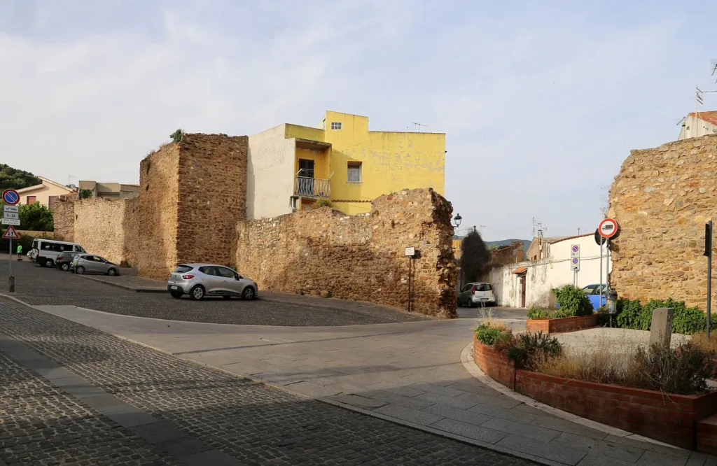
Iglesias Turismo notes that urban expansion incorporated some stretches into houses. This changes how apparent gaps should be interpreted. Where a wall seems to disappear, it is not always possible to conclude that no wall ever existed. The relationship between later buildings and defensive remains belongs to the continuing transformation of the historic centre.
As you walk, notice how space changes at the foot of the wall, how close houses stand and where a complete view becomes possible. Do not enter private property in pursuit of an imagined continuous circuit. A fence, closed gate or doorway remains a boundary even when historic masonry lies beyond it. For less legible sections, an accompanied visit may provide more insight than an improvised route.
Find the surviving sections without assuming a complete walkway
The regional Sulcis Iglesiente guide identifies remains along Via Eleonora d'Arborea and a battlemented stretch along Via Campidano. These are useful points of orientation, not a promise of an uninterrupted elevated walkway. Our walls listing on the map connects the place with other stops around the centre.
Before planning entry to towers or particular visitor routes, consult current tourist office information. Seeing masonry from the street and entering an organised route are different experiences. If mobility is a consideration, ask specifically about gradients, steps and entry points for the section you wish to visit. Proximity to the town centre is not enough to establish accessibility.
You can connect this walk with Santa Chiara Cathedral, covered in a separate guide, to explore another aspect of medieval Iglesias. For the walls, keep following the boundary: where it protected, where it allowed passage and how later urban life transformed it. These questions make it possible to recognise a former town system even when only parts of it remain.