
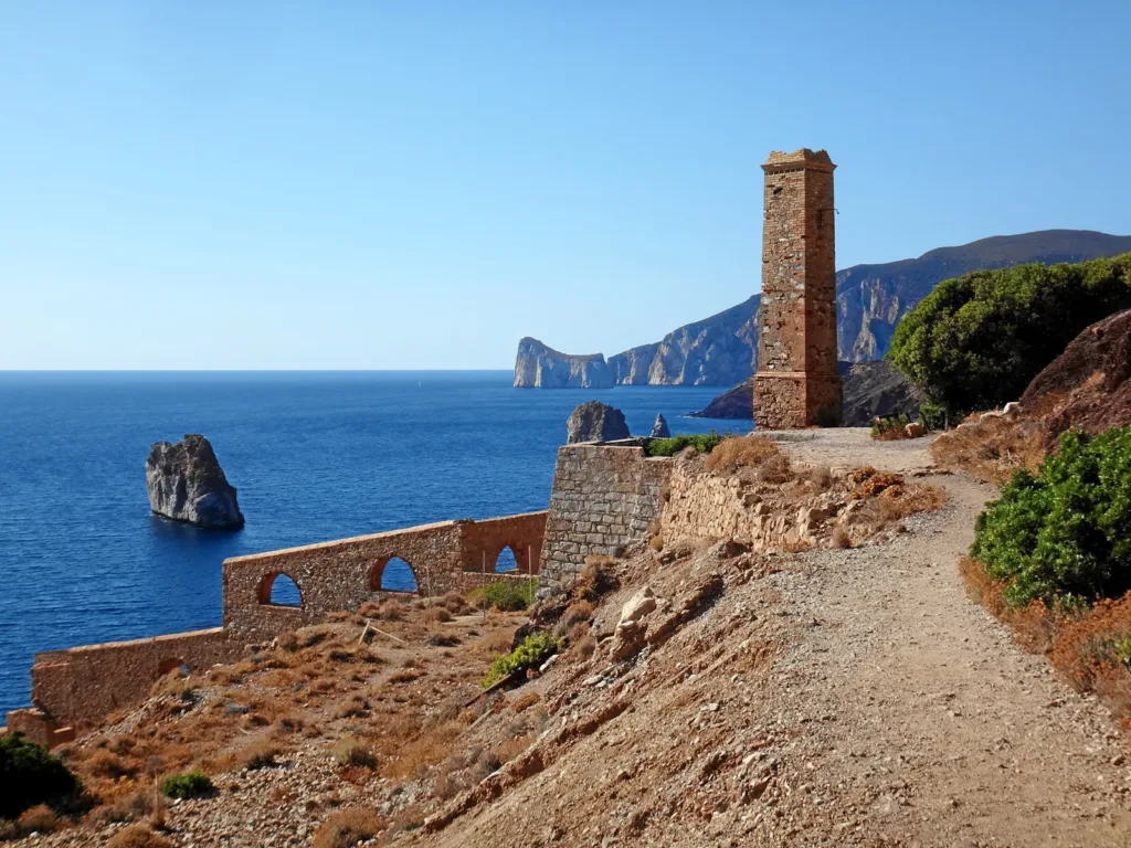

The arches of Lamarmora washery below Nebida appear to frame the sea. Their purpose, however, was not scenic: they belonged to a plant that prepared ore for later stages of production. Understanding the ruins means restoring work to the landscape, considering relationships between material, water, power and transport without inventing machinery where the evidence does not establish it.
Nebida is part of the municipality of Iglesias. The washery stands on its coast, rather than in Iglesias's urban centre or at the neighbouring mining harbour of Masua. The Lamarmora washery listing provides its map location. That point identifies a historic structure; it should not be read as an invitation to enter the remains.
What did a washery actually do?
The Geomining Park explains the plant's function as converting raw material into concentrate for shipment to smelters. Nebida used a water-based gravity-separation process. The output was enriched in useful mineral, rather than being finished metal: a washery and a smelter performed different tasks.

The word “washing” can suggest simple cleaning, but separation is the essential idea here. Removing material from a deposit did not automatically make it ready for the next industrial process. The washery occupied an intermediate stage that photographs of underground workings often leave out. Looking at this plant therefore reveals a specific part of the production chain, distinct both from excavation and from loading a vessel.
The Park's account also connects the installation with Nebida's mining company, Belgian machinery and technology, and the consultancy of engineer Giorgio Asproni. The remains consequently document the movement of expertise as well as ore. Local mining operated within wider European industrial and technical relationships rather than as an isolated activity.
Construction and permission followed different timelines
The Culture Ministry's abandoned-heritage database records excavation beginning in 1896 and masonry completed in March 1897. Its account documents operation from August 1897 but places ministerial authorisation in January 1904, following a dispute involving tuna fisheries and discharges into the sea.
These dates concern different events and should not be compressed into a single “opening”. Constructing the building, installing machinery, operating it and securing permission were not interchangeable steps. The story also reveals competing economic interests along the coast. The sea formed part of an industrial process while remaining a resource used by other activities.
The washery should therefore not be presented solely as a triumph of nineteenth-century engineering. Technical achievement existed alongside environmental questions and conflicts over shared resources. Holding these aspects together gives the landscape greater substance: the same stretch of coast could support different economies and become the subject of disagreement between them.

Why the buildings descend the slope
SardegnaTurismo describes four overlapping volumes descending towards the coast, with spaces for separation and classification, storage, steam machinery and furnaces. Lower areas were also associated with maritime transport. The changes in level encourage a reading of the building as a sequence of operations and transfers, rather than as an isolated elevation overlooking the sea.
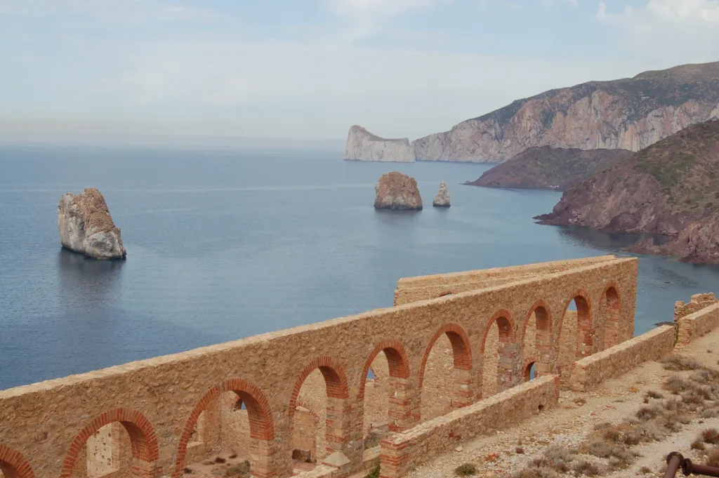
Walls, arches and a chimney can be distinguished in the photographs, while many components that gave the rooms their working purpose have disappeared. The regional account also notes the lost roof. The open appearance of the ruin can therefore mislead: the transparency of surviving walls is not equivalent to the experience of a complete plant in operation.
Repeated openings give the structure a visible scale. Comparing them with the hillside makes the relationship between architecture and terrain easier to grasp. It is unnecessary to assign a machine to every surviving space; that would require drawings and technical documentation. Recognising connected levels, and separating what survives from what must be reconstructed through sources, already provides a meaningful introduction to the building.
Nebida belongs to the context
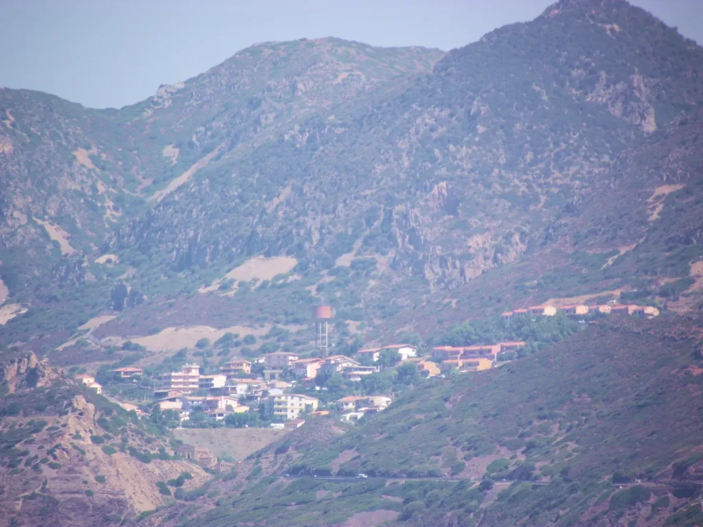
The photograph of the settlement seen from the coast of Gonnesa broadens the view. It does not show the washery's interior. Instead, it recalls the connection between industrial work and an inhabited place. SardegnaCultura identifies offices and spaces of collective life within the wider mining settlement. Exploring the village properly would require a separate route; here, the connection locates the plant within a network of everyday and industrial relationships.
This broader perspective also changes how the sea-facing ruins are photographed. A close view of arches describes construction; a distant view of the settlement introduces scale and location. The images answer different questions, and neither should be treated as a complete account of the lives of the people who worked in the mining district.
View the remains without entering them
The regional access record classifies the place as unmanaged and describes viewing the exterior from a safe distance, warning against approaching too closely or entering. Check signs and any restrictions in place when you arrive. A photograph taken in an earlier year does not establish that the photographer's position is accessible today.
To explore another stage of the mining chain, consult the separate guide to Porto Flavia, which focuses on shipping. At Lamarmora, the central subject remains ore preparation: an industrial step that helps explain why these walls were built between the mountain and the sea. Understanding that purpose adds something that a panorama alone cannot provide.