
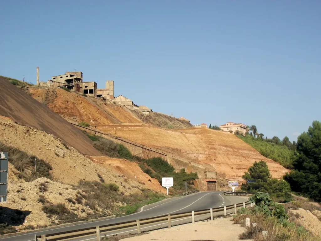

Monteponi, just outside Iglesias, cannot be understood through a single building. Mining left a landscape of changing levels, large production structures, connections and spaces designed to represent the company. In the photograph of the inclined plane, the hillside occupies almost the entire scene. The installations above and road below reveal a problem that the industrial organisation had to solve: moving materials between different levels.
The Monteponi Mine directory entry provides a point of orientation within the Iglesias complex. A first reading can distinguish four functions: extracting material underground, processing ore, transporting it and directing the work. The buildings did not all perform the same task, even when they now appear together in one view of an industrial heritage site.
The nineteenth-century complex takes shape
Research by A. Sanna and G. Monni, published by Monteponi Mining Landscape, identifies 1850 as the beginning of the company that leased the mine. The successive management of Giulio Keller, Adolfo Pellegrini and Erminio Ferraris introduced installations and changes. The site’s history should therefore be read as a sequence of projects, expansions and adaptations, rather than the simultaneous construction of a single factory.
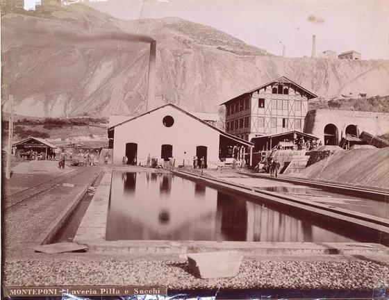

The historic photograph of the Pilla and Sacchi dressing plants, dated 1887, shows a basin in the foreground, with buildings and structures behind it. It is attributed to Vittorio Besso, whom SardegnaCultura recognises for his industrial photographic work at Monteponi. The water reflects the buildings: the image records a relationship between processing spaces and water collection, as well as preserving the installation’s appearance at a particular moment.
Different shafts for different tasks
Iglesias Turismo distinguishes the functions of the main shafts. Sella was intended to remove water that obstructed mining, while Vittorio Emanuele carried people and ore. The Villamarina Gallery connected them. The system therefore combined vertical and horizontal movement, with infrastructure responding to different requirements within the same mine. Identifying those separate purposes makes the arrangement easier to understand.
This distinction changes how a shaft is interpreted. A large building does not automatically identify an entrance used by miners: it may house machinery devoted to another essential operation. At Monteponi, water was both an underground obstacle and a resource for processing plants. Sanna and Monni also describe collecting and pumping used water back uphill, demonstrating how much production depended on managing its circulation.
The slope as part of the factory
Differences in level at Monteponi were more than a difficulty. They could be incorporated into the arrangement of processing operations and connections between plants. The inclined-plane photograph preserves the line crossing the hillside and helps connect the upper and lower areas visually. Recognising it as infrastructure gives a function to a mark that might otherwise look like a simple strip across the ground.
SardegnaTurismo also recalls the railway linking the mine with Porto Vesme. Transport did not end at the top of a shaft: the product had to reach further installations and a port. Following this chain in the imagination helps explain the complex, but does not turn it into a walkable visitor itinerary. A historic connection still recognisable in the landscape is not necessarily a route open to the public.

Bellavista and the image of management
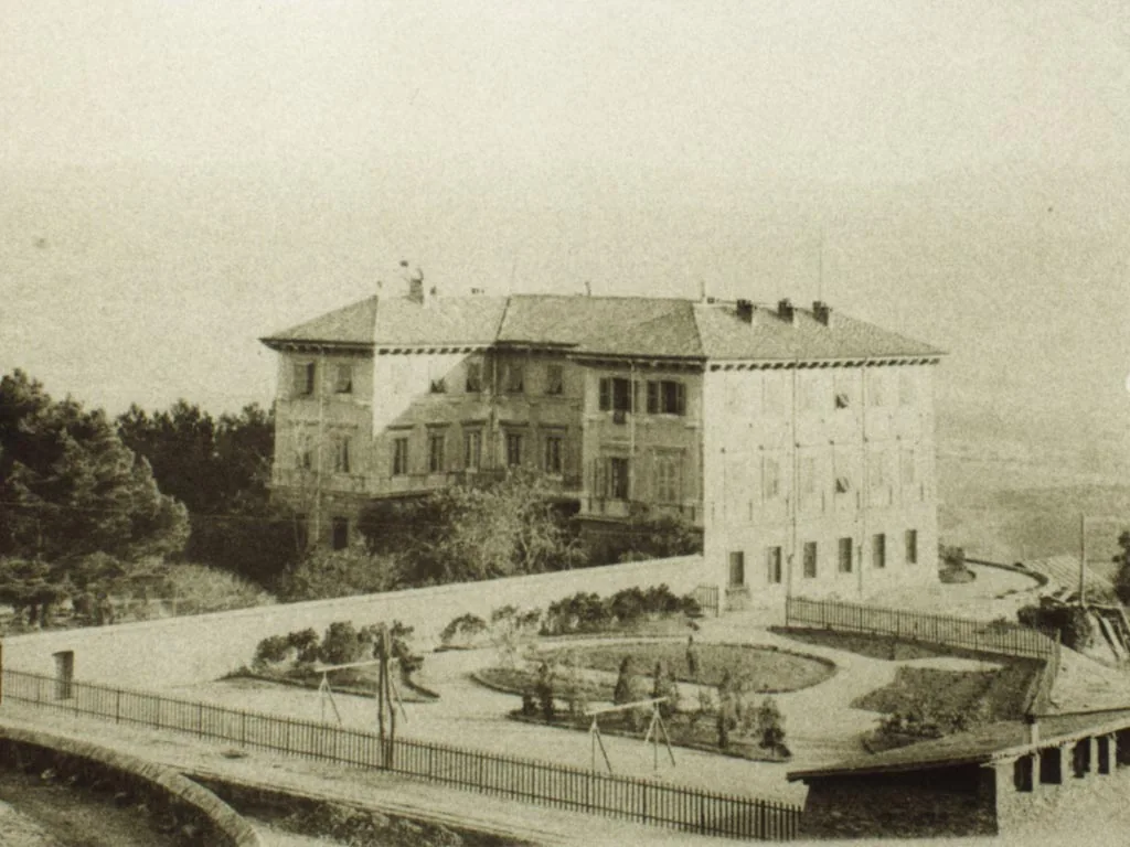
The Geomining Park attributes Palazzo Bellavista to Adolfo Pellegrini’s design of 1865 and recalls its role in accommodating the mine’s managers. In the photograph dated 1894, the palace stands behind a formally organised garden, with curved paths and a surrounding fence. Its character differs markedly from the dressing-plant view: here the arrangement conveys order, residence and the public image of management.
Comparing the two historic pictures makes a hierarchy visible within the same productive landscape. The basin and dressing-plant structures serve processing directly, while the garden mediates between the management building and the wider site. The photographs alone cannot describe workers’ daily conditions, but they clearly show that mining environments were not uniform in either form or purpose. Different parts of the complex expressed different roles.
A settlement beyond the machinery
The Ministry of Culture’s entry records a village developing around the industrial buildings, with a hospital, school, nursery and church dedicated to Saint Barbara. It could accommodate as many as a thousand workers. This account places production within a community. Mining heritage includes more than machinery: services supported the people whose continued presence was needed to keep the complex operating.
For an underground visit, consult the official Villamarina Gallery page, which specifies guided tours, limited visitor numbers and compulsory closed shoes. Check availability and conditions before travelling. Admission to an organised gallery does not authorise entry into other disused buildings. Archive photographs help explain earlier functions, while the operator’s instructions define what can be experienced today. Marine loading is explored separately in the article about Porto Flavia.