

Nuraghe Camboni lies approximately five hundred metres southwest of the modern settlement of Perdaxius. The heritage authority's report accompanying its 2024 protection document describes a complex containing a nuraghe, a village of huts and a well. It is a particularly useful source because it distinguishes recognisable remains from features that are still insufficiently understood. That distinction is central to appreciating Camboni: the site's importance includes the questions it preserves, rather than depending on a complete reconstruction of its original appearance.
A complex monument rather than a single tower
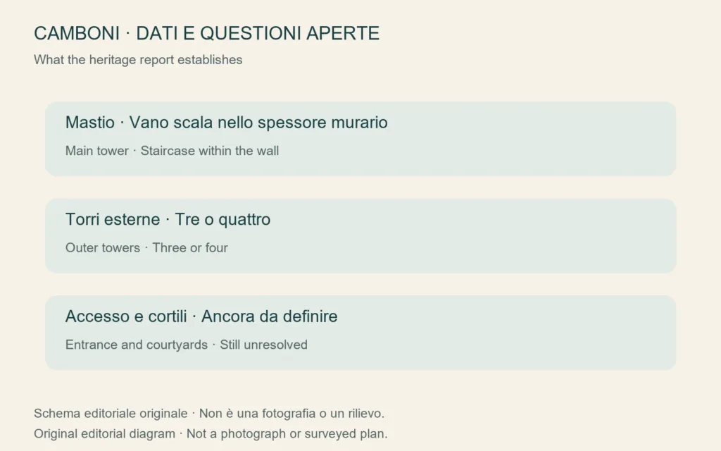
The report classifies Camboni as a complex nuraghe and identifies a central tower with three or four perimeter towers. The number therefore remains uncertain. Its masonry uses blocks of basaltic andesite with smaller stone wedges. An almost straight stretch of wall survives to around four and a half metres in places. The main tower reaches a comparable surviving height and retains a staircase space built within the thickness of the chamber wall.
These observations suggest distinguishing the central body from the structures that extend its perimeter. The Italian term mastio refers to the principal tower, while the outer towers belong to the wider arrangement of the complex. There is no need to assign every visible stone mass immediately to a particular room or passage. Surviving wall heights describe what remains today; they do not necessarily reveal the original height or establish how many internal levels the building contained.
What remains unresolved within the nuraghe
The document explains that the lack of excavation within the nuraghe prevents a precise understanding of certain aspects of its plan. Internal courtyards and the entrance are tentatively placed in the southern part of the complex. Presenting those possibilities as established features would remove a crucial distinction. Archaeologists can recognise a monument's general character while still needing controlled excavation and close examination of construction sequences to resolve the arrangement of particular spaces.
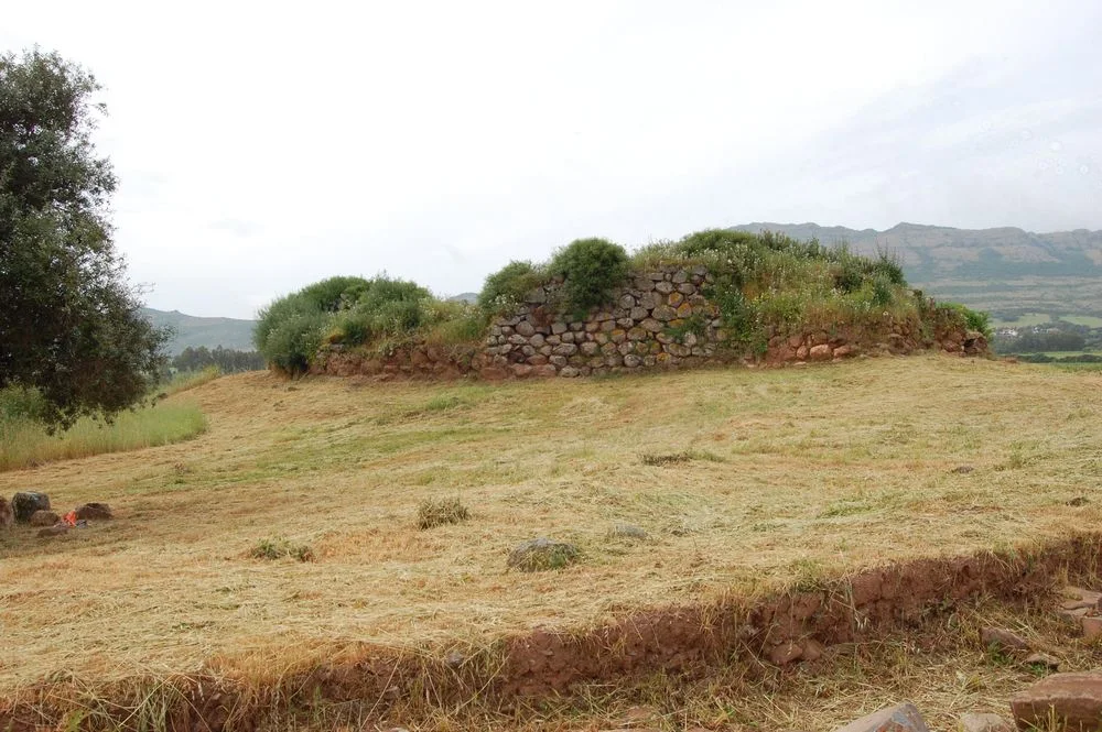
The accompanying photograph shows Camboni's stonework emerging from the ground, with vegetation above the surviving walls. It helps explain the relationship between the remains and their surroundings, but cannot substitute for a measured plan. The internal diagrams therefore separate documented observations from unresolved questions instead of inventing a complete layout. An overly definite drawing could make precisely those elements that the official report leaves uncertain appear fully established to an unsuspecting reader.
The village and its circular buildings
The research history of the village differs from that of the nuraghe. The heritage authority records systematic excavations during the first decade of the twenty-first century, involving circular huts. One building contains stone benches. This detail takes the discussion beyond a generic group of huts: internal fittings are part of the archaeological evidence and can shape questions about activities, even where the report does not assign a definite function to the room.
A bench does not automatically reveal who sat there or what kind of gathering took place. It provides a material feature that can be compared with arrangements in other rooms. Distinguishing village from nuraghe also matters when reading short descriptions of the site. Simply saying that Camboni has been excavated can be misleading without identifying the sector concerned. Research in the settlement does not resolve the gaps that the same report identifies in the layout of the main monument.
A well north of the towers
A well was identified approximately twenty metres north of the nuraghe, surrounded by circular structures. The report records a monolithic rim and suggests a bottle-shaped section, but explicitly states that excavation had reached only one and a half metres in depth. The wording is significant: the full profile is proposed, whereas the excavated depth marks the documented extent of observation. Retaining that qualification prevents a partially investigated structure from becoming a supposedly complete example in a visitor's imagination.
The well introduces water into the interpretation of the settlement. Its significance does not require the invention of a particular ritual. The relationship with surrounding huts, the form of the opening and its position relative to the towers already offer concrete archaeological questions. Keeping attention on these connections allows the site to remain interesting without adding unsupported stories, while also showing what further investigation might clarify about its organisation.
Evidence from Nuragic and Roman times
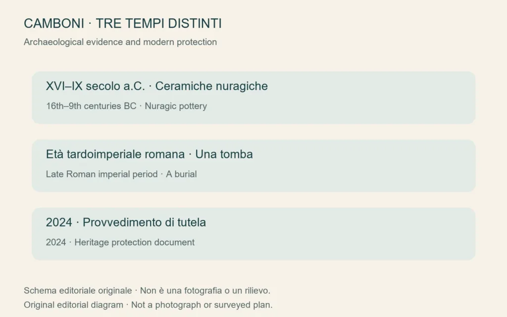
The recovered pottery is attributed to the Nuragic period between the sixteenth and ninth centuries BC. The report also notes a burial from the late Roman imperial period. These belong to different chronological contexts. The grave demonstrates later use of the location, but does not by itself prove uninterrupted occupation throughout the intervening centuries. A site's long history may include returns, changes of purpose and gaps that cannot be filled simply by listing the objects found there.
The Nuraghe Camboni directory entry provides a location reference. Recognition of archaeological importance does not imply a prepared visitor route or published opening hours; access and present conditions need checking with local contacts. Perdaxius's other previously covered stop, San Leonardo, is discussed separately. Here the focus remains on the Nuragic complex, the evidence actually recorded and the different periods represented by its surviving remains.