
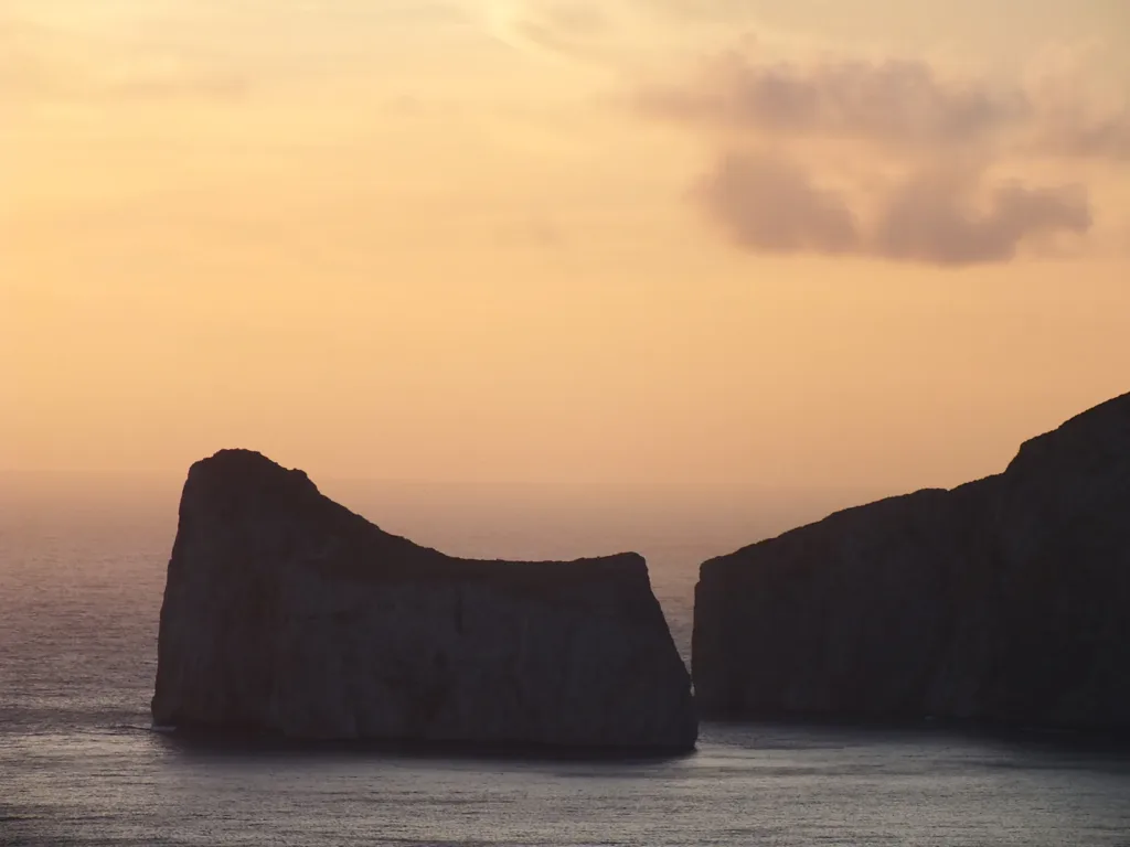

Pan di Zucchero rises from the sea off Masua, in the municipality of Iglesias, like a wall detached from the rest of the coast. According to the Ministry of Culture’s entry, it reaches 133 metres above sea level and covers approximately 3.72 hectares. These measurements help make sense of photographs: what can look like a fairly small offshore rock is a landform with walls, recesses and an uneven upper surface.
The Pan di Zucchero directory entry marks the sea stack itself, rather than a car park or pedestrian entrance. To observe it, choose a position on the coast. Establish this distinction before following navigation instructions: the landmark being described and the place from which you intend to view it may be different destinations.
Ancient limestone, a shape formed over time
The regional environmental documentation describes a predominantly pale Lower Cambrian rock known locally as calcare ceroide. The sea helped separate the block from the mainland, while rain, wind and limestone dissolution contributed to its shape. Two through-caves at sea level are also documented. The outline familiar today is therefore the result of several processes, rather than a single event that can easily be pictured.
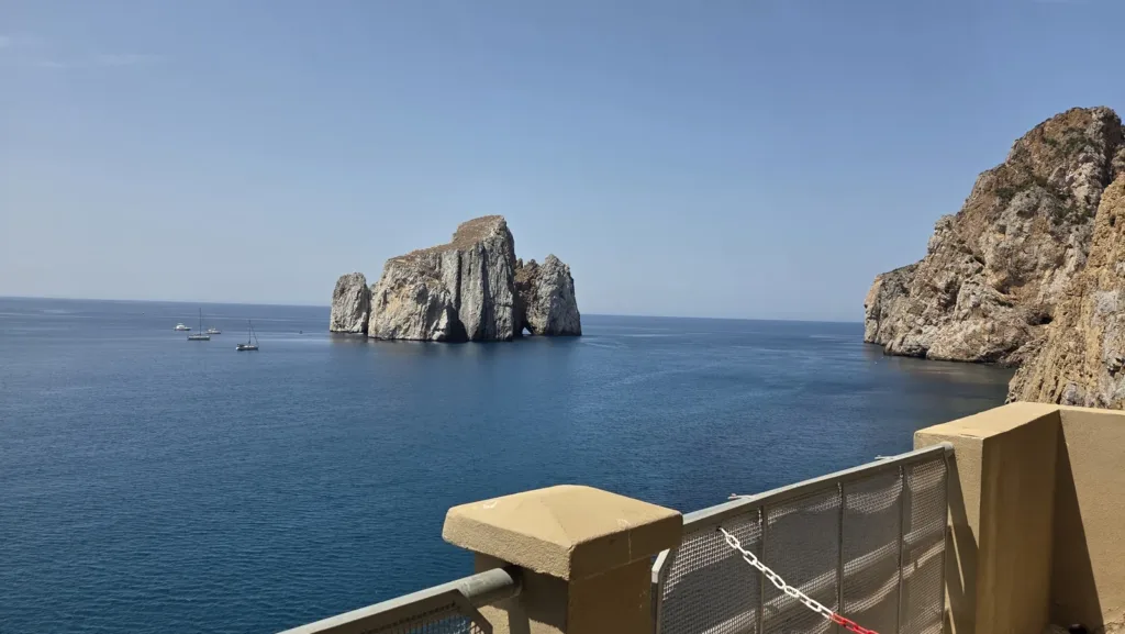

The age of the rock is not the age of its present silhouette. “Cambrian limestone” describes the material; separation from the coast concerns a later transformation. Keeping these ideas distinct avoids imagining an already isolated sea stack at the time when its original sediments were forming. In the daylight photograph, you can follow pale walls and vertical shadows without assigning a particular date or cause to every visible line.
Four rocky forms within one landscape
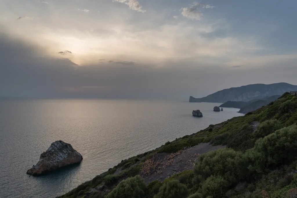
SardegnaTurismo presents Pan di Zucchero alongside three smaller stacks: the two S’Agusteri rocks and Il Morto, the southernmost. Their pale colour contrasts with darker shades along the coast. The large stack is therefore the most prominent feature within a group, rather than a completely unrelated object. The wider photograph included here helps the eye follow this succession of rocky forms along the sea.
Distance changes their visual importance. In the broad view, a nearby rock fills the foreground while Pan di Zucchero looks small in the background. A tighter photograph can produce the opposite effect, isolating the largest outline and excluding the others. Comparing both views helps you recognise the landscape: the subject stays the same, but framing changes which feature appears to dominate it.
A name and a protected monument
The regional tourism portal connects the name with the resemblance to Rio de Janeiro’s Pão de Açúcar, or Sugarloaf Mountain, and records the older name Concali su Terràinu. The comparison is primarily visual: similar names do not establish that two landforms have the same geological origin. The Ministry of Culture also records the measure dated 29 April 1993 establishing the natural monument named Pan di Zucchero Faraglioni di Masua.
That designation encourages descriptions to include the smaller rocks too. A precise caption can distinguish the main stack from the coastal sequence, rather than calling everything “a rock near Iglesias”. The choice of photograph matters as well. Sunset emphasises the outline, daylight makes the surface easier to read, and a panorama restores the relative positions of the rocky features.

A rock face supporting plant life
The municipality of Iglesias’s publication on natural monuments describes plants adapted to the cracks, small ledges and marine exposure of Pan di Zucchero. Among the species it lists are Limonium sulcitanum and Brassica insularis. Apparently sparse vegetation does not mean an absence of natural interest: it occupies restricted spaces where rock and sea spray create particular growing conditions.
The same document draws attention to potential damage from removing plants when opening climbing routes. This is a specific connection between recreational use and conservation. From the mainland, observers mainly take in the overall landscape; recognising individual species requires a different kind of observation. The panoramic photographs in this article are not botanical identification plates and cannot establish what every green patch on the rock face represents.
Looking from Nebida and Masua
Iglesias Turismo describes the Nebida Belvedere as a paved circular walk with a railing along its outer edge, offering views of Pan di Zucchero and the three smaller stacks. It provides a practical reference for seeing the group from land. The cover photograph, taken from Nebida’s panoramic promenade, also demonstrates how backlighting can turn pale limestone into a dark silhouette against the evening sky.
For a photographic comparison, keep one wide frame and another concentrating on the main stack’s outline. Do not infer today’s sea conditions from archive photographs: boat excursions require current information from the operator, while climbing is a technical activity to arrange with suitably qualified professionals. The mining installation facing the same stretch of coast has a separate history, explored in the guide to Porto Flavia. Here the focus remains on the natural monument and the different scales at which it can be observed.